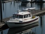
Bob...Bob Austin beat me to the invite...
Hi Bob!
Agree you don’t often need radar for this trip.
Much of the southern ICW can be thought of as a 9 foot ditch with tugboats and barges that have a 10 foot draft plowing through it. There are no fast ferries etc. Get out of the way by going just outside the ICW channel. Receive-only AIS is a $200 black box I rec’d over radar as you can talk directly to targets (which show up labelled on your plotter) by name or direct MMSI call to their bridge.
Don’t travel at night, you’re on vacation.
I’m sure you’re aware of the dearth of marinas/fuel between Demopolis and Mobile (no marinas in Mobile either).
If you haven’t resolved your fridge issue yet, when time is short the easiest option is to replace it with the same new model. That way you know it will fit in the cavity, and it’s only 4 screws and an AC and DC plug to plug in and voila, new fridge is working.
Do you have military ID? (I notice you’re starting in a small USAF town and ending in a big Navy town). If so the PNS NAS Navy Bayou Grande marina has hot showers, no fuel (Sherman Cove is right on the ICW but no showers, but has 88.5 ethanol free gas @ $3.50/gal). Directly across is Ft McCrae cove, a protected deep anchorage since 1648. If we’re here (no plans now) we’d be glad to give you a ride to WalMart or West Marine or bx or other shopping.
See reviews of Marriott Point Clear Marina on East side of Mobile bay, not many transient spots but you can use indoor heated pool and public areas, great restaurant with sunset views. After Mobile bay, see reviews of LuLu’s (Jimmy Buffett’s sister’s place), The Wharf marina, Pirates’Cove burgers, and The Oyster Bar at Perdido. If winds are gentle and from the North (or if you’re casting off at dawn) consider going out Perdido Pass into the Gulf and hugging the sandy Gulf shore up to Pensacola Pass. The last portion is 6 miles of pristine Gulf Islands Natl Seashore. Due to shorebird nesting this time of year, you mostly can not walk across from the Gulf to ICW sides except at boardwalks which don’t show on your nautical maps but do on Google Earth. Ends at Ft McCrae ruins and the ‘cove’ there.
Onboard NAS PNS you can visit/climb the historic lighthouse and visit the Navy Air Museum with civilian ID. See
http://www.navalaviationmuseum.org/attr ... ue-angels/
for the current Blu Angels practice schedule.
If winds are North and gentle, again you can venture out Pensacola Pass and hug the shore over to Destin Pass, along many miles of USAF owned pristine Santa Rosa Island doing 6 MPH at 3 feet you’ll see and can avoid the sugar sand bottom and 2nd sand bar.
After Destin, Sandestin Baytowne marina has a few transient slips (many million$ boats) but great food and free trolley to the beach and pool access. Call ahead.
Panama City has 2 nice city marinas, the eastern one with bus transport to the mall. TAFB marina has no transient slips or power.
If you like hiking long pristine beach islands, St Joe Penn State Park is the next one, or St Joe Marina the alternative. Next up St Vincents Island, very difficult, very shallow, fast tides and no nav info, take the pontoon ferry and island bike tour instead.
Next up Dog Island, private but sandy beaches. Don’t tie up at ferry or seaplane docks, run aground out of the way.
That gets you to the Big Bend and the end of our familiar areas until Tampa.
Dog Island to Crystal River I'd think of as a 'jaunt', not an 'overnight', but of course that depends on on your speed and time of departure. 30 MPH @ dawn on April 10 and the math says 'no problem, man'. Even if you leave 6 hours after dawn. No problem, man.
Have a great trip, email me for info
johnhighsmith9@gmail.com.
John

