Raytech Planner

Pat Anderson

New member
(Breaking this off to a new thread with an appropriate Subject line - WAS "Navionics NavPlanner")


Not sure if you can transfer Navionics charts to your computer but you can access them in Raytech Planner with a proprietary CF card reader, which I will probably buy, and use them for route planning. However, the package comes with Navionics charts of the whole world sufficient for gross route planning built in, and can install any MapTech BSB format charts it finds on your hard drive, so you don't need the card reader for this to be useful. Anyone who has a Raymarine multifunction display like the C-80 will instantly know how to use the software - it looks and behaves like the Raymarine display, right down to the hardware buttons and soft keys. I am with Gary, this sure LOOKS like what the Navionics NavPlanner should have been but wasn't, and for free to boot. I am going to play with it a bit more before posting any more on it. I will save some routes to my CF card and transfer them to the C-80, but that is a couple of weeks out, since Daydream, my C-80 and my CF card are still in Alaska at the moment!


flapbreaker":19ls6pho said:
Can you transfer the navionics charts into the Raytech planner ?
 
OK, took a while, but I have now fairly fully explored this puppy, and it is exactly what we had all hoped the Navionics Navplanner would be but wasn't - and it is free to boot! Anyone with a C80 or E80 should download this guy and pick up an inexpensive Compact Flash (CF) card pronto. I plotted our Matia cruise in about a minute (didn't really need to, but was testing), saved to a file and transferred to the C-80 on a CF card, I WISH I had had this for the Alaska cruise, it would have been perfect!

This is the full Raytech nav software, which when installed without a license key, operates in planning mode only. It lets you enter waypoints and routes with your mouse on a pretty good map, save them to a file (archive.fsh), which you then can import easily into your C80 / E80. This eliminates the last advantage that Garmin had over Raymarine, which was planning on a computer and easy transfer to the chartplotter. Actually, using the CF card is easier than physically connecting computer and chartplotter for data transfer - advantage Raymarine.

You can buy a proprietary CF reader to use your Navionics CF chart chips with Raytech Planner, but I discovered a couple of other things in using it since initial post. First, you can choose between built in Navionics or C-Map vector planning charts, and the C-Map charts are 1000% better - they really are good enough for all your route planning. Better yet, Raytech Planner will search your hard drive for your raster charts and install them, and you can choose vector or raster charts, or both, with a transparency slider on the raster charts - at 0% they are invisible and at 100% they completely obliterate the underlying vector chart. So you can overlay the raster chart a little or a lot for more info if you need to. Naturally there is chart quilting.

The software interface mimics the C80 / E80 chartplotter you already know - right down to the hardware buttons and soft buttons. It also adds a full Windows menu of course. It is really pretty easy to use. It suffers from the same quirky Raymarine illogic in grouping functions that the Raymarine chartplotter does (show/hide waypoints isn't under the waypoints menu, it is on the chart layer menu under the Raytech menu item, for example). But you already know this about your C80 / E80, and it is a fairly minor inconvenience once you learn where the heck the function you are looking for is hidden. The Help is more than adequate as well.

All in all, a big thumbs up, this is my new route planning software, since it is free it is on all my computers. Highly recommended.
 
Pat Anderson":33853ami said:

You can buy a proprietary CF reader to use your Navionics CF chart chips with Raytech Planner, but I discovered a couple of other things in using it since initial post. First, you can choose between built in Navionics or C-Map vector planning charts, and the C-Map charts are 1000% better - they really are good enough for all your route planning.


Ok, help me here. What proprietary CF reader would I use for my Navionics chip? And do you mean to say that my Navionics maps are not good enough for rout planning :disgust kinda scarry since that's what I navigate with.

So if I get a CF reader for the Navionics I can then load the map to the computer for use in Raytech? Sorry I'm kinda slow with this stuff.
 
Yes, with the proprietary card reader you can use your Navionics chip with Raytech Planner on your computer. But the Raytech Planner comes with Navionics and C-Map vector charts built in, the Navionics vector chart built in to Raytech Planner is not very good (very gross level) but the C-Map built in vector chart is great (a lot more detail). Your Navionics charts on the CF cards that you insert in your C80 / E80 are of course better, but then you would need the proprietary card reader. Raymarine sells the necessary card reader, but I now think you don't really need it because the combination of the built in C-Map vector chart plus the raster charts (which you can get for free) are more than adequate for waypoint plotting / route planning. Here is the link to the NOAA Office of Coast Survey raster chart download site.


flapbreaker":3snw1rau said:
Ok, help me here. What proprietary CF reader would I use for my Navionics chip? And do you mean to say that my Navionics maps are not good enough for rout planning :disgust kinda scarry since that's what I navigate with.

So if I get a CF reader for the Navionics I can then load the map to the computer for use in Raytech? Sorry I'm kinda slow with this stuff.
 
For those of you who have early computer junque lying around, an old SanDisk CF card reader worked in my system as did an early Lowrance "Proprietary" CF card reader (which is, in fact, a Lowrance labeled Sandisk CF card reader.)

Good luck

Don
 
That is why I said you will "apparently" need the proprietary card reader...If anybody really knows, do you actually need a proprietary card reader? Is there some technology in the Navionics CF card with the chart data that prevents it from being read in an ordinary card reader, or more to the point, will damage the Navionics chart data if you try to read it in an ordinary card reader? I am just not willing to risk frying my expensive Navionics card by sticking it in an ordinary card reader without knowing for certain that it is OK to do this...


Sneaks":24h6s6ts said:
For those of you who have early computer junque lying around, an old SanDisk CF card reader worked in my system as did an early Lowrance "Proprietary" CF card reader (which is, in fact, a Lowrance labeled Sandisk CF card reader.)

Good luck

Don
 
Yes, you really need to have the Navionics card reader. They use a proprietary OS on the cards that makes them unusable without their reader. While you can see the file you can't do anything with it. At least that is the case with my SD card for my Lowrance H20C. You also can't copy the file to a larger non Navionics card (I had hoped I could do this so I could add more maps to the single card and not have to change cards).
 
I played with the software some tonight. Figured out how to get the correct chart to display. Why does the boat defualt to a position in florida? Not to mention that region has all the tide stations shown but none are shown on the west coast?
 
Oh, one more question. Is there any way to safely power on the c-80 in the house? It would be nice to be able to have it turned on right next to the computer.
 
Zoom out (zoom in or out is Tab and Shift/Tab respectively), and click on your area of the world. The next time you start Raytech Planner, it will start up wherever you were when you last shut it down, although being in Florida is nice it is not necessarily useful for planning San Juan cruises! Check Help for "tides" to read the info - you have to set the region, I have mine set to US West Coast (duh), and it works great. Like any software, this takes a bit of playing with, and occasional reference to Help is also a good idea if you get stuck.


flapbreaker":3cxh5doa said:
I played with the software some tonight. Figured out how to get the correct chart to display. Why does the boat defualt to a position in florida? Not to mention that region has all the tide stations shown but none are shown on the west coast?
 
Not that I know of - advantage Garmin on that one. My old Garmin had a combo AC adapter - computer interface cable that simply plugged into the back of the chartplotter display. It does not seem anything comparable is available for the C80 / E80. Plus it looks like it would be a significant PITA to get the C80 display disconnected and off the boat, no?


flapbreaker":pgughyfl said:
Oh, one more question. Is there any way to safely power on the c-80 in the house? It would be nice to be able to have it turned on right next to the computer.
 
Pat Anderson":x3k8n68e said:
Plus it looks like it would be a significant PITA to get the C80 display disconnected and off the boat, no?

Fairly easy to remove the display if it isn't built in. Lot harder to get it working remotely 'cause ya gotta remove the GPS puck and wiring if you want the display to look/feel authentic, plus you need a second power cable and either a battery or a good filtered 12 volt DC power supply. Nephew is correct. Significant PITA. Easier to park the boat/trailer next to the house and set your computer up on the boat temporarily (or use a laptop there.)

Advantage Laptop :mrgreen:
 
You should be able to buy another power cable. There any number of power supplies (Radio shack has them, or I use my Ham radio power supplies) which will provide good filtered 12 V Dc current.

I didn't down load the files--but I am a little surprised that C map charts are on it. Raymarine dumped C map several years ago, and who ever is producing the soft ware should be paying a royality to C map. Or is this for the older Raymarine units which could use C map?
 
Yeah, I don't know the details of Raymarine's relationship with C-Map, but the software package you can download from Raymarine is Raymarine software, and certainly does include both Navionics and C-Map vector charts...I flip and flop, but am probably going to buy the proprietary card reader so I can use my Navionics Gold CF cards, one covers from South Puget Sound pretty much all the way to Queen Charlotte Sound and the other one covers everything north of there that I could ever imagine needing...I do have a good 12 volt supply (being KD7OAC myself), but it just seems that saving from your computer to a CF card, carrying the card out to the boat, sticking it in the C80 and hitting "import" is a lot easier than physically moving the C80 around.


thataway":aheq78ic said:
I didn't down load the files--but I am a little surprised that C map charts are on it. Raymarine dumped C map several years ago, and who ever is producing the soft ware should be paying a royality to C map. Or is this for the older Raymarine units which could use C map?
 
I keep my c-80 in the house and the boat at a storage facility so you can see why I would like to at least be able to power the unit on at home. But again it's probably not necessary. I do want to use my navionics maps from the chartplotter since it has all the bouys and so far it doesn't look like the one that comes with the raytech does but I'll keep fiddling with it.
 
One thing I have found is pretty cool is to quickly route plan on the C-Map vector chart at the gross level with the raster charts set to 0% transparency, then to bring the raster charts up to maybe 50%, so you can see a lot more detail overlaid and drag the waypoints around to miss rocks, stay in deep water, etc. - my raster charts are the MapTech ones that came on CD with my Puget Sound and San Juan chartbooks, but I have a bunch of NOAA raster charts too, and they do have all the buoys, rocks and other detail stuff...Here is a screen shot (this is Everett to Port Ludlow):

RayTech_Planner_Screen.jpg


flapbreaker":3knmlcjl said:
I keep my c-80 in the house and the boat at a storage facility so you can see why I would like to at least be able to power the unit on at home. But again it's probably not necessary. I do want to use my navionics maps from the chartplotter since it has all the bouys and so far it doesn't look like the one that comes with the raytech does but I'll keep fiddling with it.
 
Pat,

What kind of chartbooks do you have?? I'm interested in the raster charts. I don't have any now.

Thanks for "test driving" this product.
 
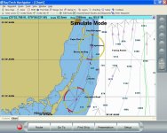
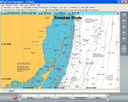
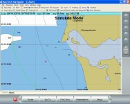
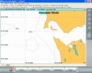
So Pat, it doesn't look like your using the default charts then because I don't have near the detail that you are getting. I've posted some comparison pictures. Two of them are from the florida location that it defualts to. Interestingly enough both cmap and navionics have much more detail in this region than the other two pictures of the Columbia river mouth. There's no tide stations or bouys to speak of listed. I can access tide data but just no tide stations on the map.

c-map
florida_cmap.jpg

Navionics
florida_navionics.jpg

Columbia River entrance.
c-map
CR_cmap.jpg

Navionics
CR_navionics.jpg
 
Most of the detail is on the raster charts that are overlaid over the C-Map built in vector chart - I have the raster chart transparency set to about 50%, so it appears lighter (and the raster chart does not completely hide the vector chart). I'll bet you can get the raster charts you need for the detail you want from the NOAA Raster Navigational Chart download page. An interesting note on your area, it appears the Navionics base chart is better than the C-Map...here it seems just the opposite, but whatever works!


flapbreaker":2kxbjp3a said:
So Pat, it doesn't look like your using the default charts then because I don't have near the detail that you are getting.
 
Back
Top