Hi Pat!
“NOTE B: WEST PASS CHANNEL: The West Pass Bar Channel is subject to extreme shoaling and is unreliable for navigation” in big letters on St Vincents Island…been there, done that, got the T-shirt.
Bob beat me posting, but I won’t change anything as we basically agree on all…
What you're missing is the proper scale.
That map area in person is a LOT bigger than it looks. Two 50-foot boats can pass abreast in that channel and do so daily. Look at that same area on Active Captain Interactive Map Nautical view then switch to Hybrid view and zoom in (with mouse scroll wheel) until you can see the Apalachicola City Marina launch ramps and parking area. Also see the tricky area East of the Highway 300 bridge where the ICW is winding between shoals. I've found using Active Captain satellite view this way increases my confidence navigating new areas. Google Earth allows more zooming in details, but you can't switch to the Nautical Chart view instantly for the same area like you can with Active Captain maps.
I've found another excellent source of local boating info is to call the local Sea-Tow office by phone (esp when they are less busy in the mornings)...they would rather not have to come rescue you from a problem area whether you are a member or not. Just say you're visiting and ask about any hazards or issues you should know about to stay out of trouble on your route. The nautical charts are cluttered with scary-looking “subm pilings”, “fishing platform ruins”, “wreck PA” which may have been washed away 20 years ago. The Sea-Tow Capt will know about that semi-submerged dredge pipeline that was just placed yesterday.
There are many shoal areas along the Gulf coast. The chart datum is 'mean lower low water (MLLW)' which is the average of the lowest low tides over a 19 year period. So the real depth might be 3 or 4 feet at low tide in an area marked 2 feet. Or, if you're there at an astrological low tide, it could be a foot lower (though rarely) than marked. The average Gulf tides are 2 vertical feet or less. Use tide charts that show the numbers above and below '0' (MLLW). (Brent can correct me here, oversimplifying for clarity).
The Gulf ICW project depth is 9 feet, but many areas get shoaled in to 6 feet esp near cuts, rivers and with storms. The larger coal barge towboats have 8 foot drafts and 10k HP props that chew right through the sand (or a large tree trunk, or NAVAID piling). They will trail a mile of more of churned up sand and help keep the trench at project depth. They may also churn up a sunken fridge, so be aware. That sand may give your impellers indigestion. The Army Corps of Engineers (who keep the ICW dredged, and who, incidentally, mark it in statue miles rather than nautical miles because they are Army, not Navy) will only dredge as narrow a trench as they can from one red triangle to the next and from one green square to the next green nav aid. It might be 1-2 feet deep or a dry sandbar right next to the nav aid piling. Dredged sand might be just outside the ICW trench/channel and may not be marked 'spoil area'. Therefore, after passing one set of markers you must draw an imaginary line with your eyeballs from the last port/starboard marker to the next one, and not drift out of those lines (the narrow channel), which is easy to do when looking ahead and not behind. Often the next set of markers is placed just within un-aided eyesight up to 1-2 miles away. Few turns are at 90 degrees like shown. Many markers get plowed down by barges. Just stay in the center when in shoal water and you'll be fine.
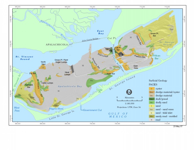
If you decide to go out into the gulf use 'Govt cut,' don't even consider East or West pass. Most of ICW here is soft sand or sandy mud rather than rocks and oyster beds, so most soft groundings are no big deal. We have not explored past Dog Island (where the ICW ends). The Big Bend is as lonely and long as it looks, so pick a weather window as a long fetch + wind + very shallow water makes for unpleasant chop and you can’t hug the marshy coast.
You might also want:
https://www.amazon.com/Cruising-Guide-F ... 1589800729
We heard Capt Rhodes talk at a Miami Boat show seminar...cool but now dated somewhat.
Happy Boating, and have a Grand Adventure!
John