colbysmith
Active member
Didn't see any recent threads to hijack, so thought I'd start a new one. original plans were to put in on Kentucky Lake, looking for places to possibly revive the Meet in the Middle gathering. For now, not going to follow thru with that idea. But I did find out, while several suggested I look at Moors Marina, that marina does not allow folks to stay on their boats. Green Turtle Bay was much more receptive to the idea and they do allow transients to remain on their boats.
We launched at Kentucky Lake Dam State Park Marina. There are no docks to use while launching your boat, however there are some docks very near by. Relatively steep ramp, so no problem launching. Water this time of year was about 5' below summer normal. I notified the ranger office that I was parking my rig for several weeks, and he asked that I park in the upper level lot and took down some information. They do patrol and like contact information. Headed south on Kentucky Lake to check out Moors Marina. Then back down stream and through the Barkley Canal to Lake Barkley. Stopped at Green Turtle Bay marina, before continuing south.
Passed the Castle on the Cumberland. Pretty impressive structure. This is what they call the Tennessee State Penitentary.
The first night we anchored in Mammoth Furnace Bay. Very secluded and quiet this time of year. I followed the deeper channels shown on my chartplotter to enter the bay. There are no marked channels with buoys to follow in, and with the lower water levels, you have to pay attention to the charts. I never saw less than about 8' of water until I was in a cove next to shore. I anchored just about where the anchor symbol shows on Active Captain. It did take several tries to get a good hold. Some birds just stood by and watched. I suspect the bottom is very soft mud on top of rock. With a water temp of 62 degrees, and night air temp of 43, there was steam fog in the morning. It burned off quickly. One washed up red nun buoy on the shore. Leaving the next morning, I again followed deeper areas shown on my chartplotter, but pretty much went straight across Lake Barkley to the other side where the main channel was.
Very few other boats on the water. This was during the week. Mostly fisherman. The next night we anchored in Dover Island chute. Before getting there, we considered stopping in Dover, but the ramp dock was in poor condition and had some locals fishing off of it. One had a large inflatable pad that he was laying on. The area next to the ramp/dock was pretty rocky, so I decided against beaching there. Continued into the chute. Had one tow go by on the main channel as we anchored. Anchored at the upstream end near the main shore in about 10 feet of water. Good hold in mud. I also set out a stern anchor, as the wind was more controlling than the current, and we had a wind against the current. Another quiet and secluded night. More steam fog the next morning due to the night's cold air temp.
Next morning we pulled out of the Chute behind a tow. Followed him for a while at 5 kts, then passed and picked our speed up as we had a time we wanted to be at Clarksville by. Pulled thru the chute at Cumberland Island, by the Tennessee Valley Authority Cumberland Steam Plant. Lots of working barges in the area that haul the coal for the plant. After leaving the chute, we watched the Cumberland City Ferry operate. It is one of those that has an articulating T configuration. (Tug is attached at the side of the ferry barge, and swings depending on direction of travel.) I called the Ferry captain on CH 13 and asked if he minded me coming within 50 yards to get some photos. He said not at all and asked if I was taking video or still. Ended up he wanted a video, so I captured video and then texted it to him as he provided me with his cell number. In turn, he texted me back the view from the bridge. Stopped at an old lock wall (lock no longer exists) for lunch. (Next to the Yellow Creek) Today we saw several fishing boats and a few recreational boats. It's Saturday. Stopped at the McGreggor Park courtesy docks in Clarksville to empty the porta potti and dump some garbage. Not impressed with the space here. The ramp/docks porta potty was a full mess. I didn't see any other toilet facilities nearby. Docks are ok for a quick lunch stop or something, but not sure I'd want to tie up here over night. I believe there was also a sign on them saying for loading and unloading only. However it also listed a number to call if you were looking to stay overnight. Continue another mile upstream to the Clarksville Marina, which is fairly new, and fairly nice. They discount gas 10cents a gallon with Boat US, and dockage 25%. For our 25, our covered slip with 30 amp service for the night was $30, only $22.50 with the Boat US discount. For those needing a pumpout, there are pumpout connections at each slip, along with potable water. Several restaurants nearby, one just at the top of the hill right at the marina.
For this cruise, I'm using the Cumberland River Guidebook by Jerry M Hay, which is the guide book I'd recommend for anyone else cruising this River. Lots of good and detailed information, easy to follow.
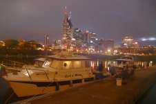
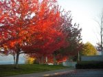
Tomorrow we'll continue heading upstream. Plans are to get to Nashville by Monday evening, maybe spend two nights, before turning around to head back to Kentucky Lake Dam State Park and pull out. I've been running both at displacement speeds and on plane. I did hit a lot or large branch today while up on plane. No damage, but it did leave some splinters in my outboards trim anode. Haven't seen much debris in the water, and this one was apparently just below the surface. Was hoping to see a little more color in the leaves, but maybe we are about a week or two too early. There is some color, but not a lot.

