You are using an out of date browser. It may not display this or other websites correctly.
You should upgrade or use an alternative browser.
You should upgrade or use an alternative browser.
Duwamish River
- Thread starter RobLL
- Start date
Spike
New member
- Joined
- Oct 21, 2006
- Messages
- 572
- Reaction score
- 0
- C Dory Year
- 2007
- C Dory Model
- 22 Cruiser
- Vessel Name
- Bootleg Hooch
Not much more than a mile up river from the 1st ave bridge. Delt Marine Wil be on the west side, Boeing on the east. Not much to see unless you find the gritty industrial side of a river way interesting. Which I do by the way
What you consider navigable will depend upon the tide elevation and your sense of adventure. The Duwamish is definitely navigable past the South Park neighborhood up to the Delta Shipyards and the Duwamish Yacht club. At high tide I have taken an inflatable with a short shaft outboard up as far as the I-5 bridge. There is a large boulder and a rapid that is exposed at low tide slightly north of where highway 99 crosses the Duwamish. Good luck with your adventure!
RobLL
Member
- Joined
- Aug 5, 2014
- Messages
- 422
- Reaction score
- 0
- C Dory Year
- 2007
- C Dory Model
- 22 Cruiser
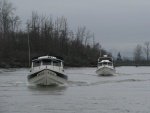
I did it today with a friend. Much fun. He is a bicycler (several thousands of miles a year) and is familiar with all of this from shore. He was delighted with all of the things he had not seen from shore. A fun October sunny day!
hardee
New member
- Joined
- Oct 30, 2006
- Messages
- 12,637
- Reaction score
- 2
- C Dory Year
- 2005
- C Dory Model
- 22 Cruiser
- Hull Identification Number
- Brat # 2202
- Vessel Name
- Sleepy-C
I don't remember the river name, but Dave from SeaShift, the redstrip 22 used to lead a C-Dory run up a river. I even got to ride with him one day. Have some pix in my album, but don't have the river name. (I think it was the Snohomish.) It was fun, but WOW, was it shallow in places. And tha'ts from the guy who likes to anchor in 5 feet at low tide.
My album:
http://www.c-brats.com/modules.php?set_ ... _album.php
Harvey
SleepyC :moon

My album:
http://www.c-brats.com/modules.php?set_ ... _album.php
Harvey
SleepyC :moon

Marco Flamingo
Active member
- Joined
- Jul 9, 2015
- Messages
- 1,170
- Reaction score
- 1
- C Dory Year
- 2004
- C Dory Model
- 16 Cruiser
- Vessel Name
- Limpet
I went up "all the way" several decades ago in a boat twice the size of my C Dory. I remember coming to a low bridge. The tide had changed and there were ripples on the water from the river current. With the tide dropping, I called it a day. I could probably get under the bridge and continue on with my 16, but . . . The most interesting stuff that I saw was in the first 1.5 miles. And it was interesting enough that doing the Duwamish was fun. That is assuming that you like looking at gigantic commercial vessels, gritty industrial areas, monstrous loading facilities, etc. It's a scenic river, but not in the normal way.
Mark
Mark
localboy
New member
- Joined
- Sep 30, 2006
- Messages
- 4,673
- Reaction score
- 0
- C Dory Year
- 2007
- C Dory Model
- 25 Cruiser
- Vessel Name
- 'Au Kai (Ocean Traveler)
Dave led the way up the Snohomish from the Everett launch (10th Ave). I went one year and we went all the way to the SR9 bridge and turned around. Several years later I went with a friend, to fish for pinks in his alum skiff. We launched just above the bridge and went east towards Machias Rd which is a lower bridge. The water disappears very quickly east of downtown Snohomish past Machias Rd; lots of bars, banks, rocks and we bounced off a few at low speeds. I then understood why we turned around at the bridge.
There are multiple routes at the estuary. One goes under the SR2 trestle. I Think this is the Ebey lsough? That route is to the east of the main channel. Depending on tide & river flow, that can be a very low bridge with water under your hull OR a high bridge with very little water under your hull. I cross that trestle daily. That route is also artificial as it's levy supported on both sides.
From Harvey's album. This is the SR9 bridge: http://www.c-brats.com/modules.php?...ame=gallery&file=index&include=view_photo.php
Capn Jack
New member
- Joined
- Oct 1, 2007
- Messages
- 527
- Reaction score
- 0
- C Dory Year
- 1988
- C Dory Model
- user_field_choice.c_dory_model_16_Angler
- Hull Identification Number
- DOR15108E888
- Vessel Name
- Pocket Yacht
Years and years ago we took our 14' Run-a-bout up the Duwamish.
Is that old Whaling Catcher Ship still there? I remember it because it
still had a Harpoon Cannon mounted on the bow. :smileo
Is that old Whaling Catcher Ship still there? I remember it because it
still had a Harpoon Cannon mounted on the bow. :smileo
