Intuition to Alaska - 2021

Les, I just checked Kel's blog and on the first photo, boat under the chapel I noticed those bow cleats. AWESOME. If you need something to write about at some point a What, where and how would work there.

Final.sized.jpg

Harvey
SleepyC :moon

January_2010_344.thumb.jpg
 
Yesterday's update:
Tuesday, June 15
Port Neville to Clam Cove

Distance today: 84.3
Motor hours today: 8.7

Woke up at 4:30 and looked outside to very thick fog, so went back to bed for a while. We left shortly before 8 when we had at least a quarter mile visibility. This was the first operational use of my horn connected to the Standard Horizon VHF’s fog horn functionality. It’s certainly annoying in a quiet anchorage, but at least safe and legal.

Visibility improved in Johnstone Strait, and the water remained smooth, so we cruised on plane (14-15 knots) most of the 48 miles to Port McNeill. We filled up with gas and water, and IGA delivered groceries we ordered a few days ago. Altogether a smooth stop for less than an hour.

Fuel management and stats:
I filled with 255 liters of gas at Port McNeill today plus the 100 liters added yesterday in Campbell River, which equates to almost 94 gallons. We ran 267 miles since filling in Roche Harbor, yielding 2.85 mpg. I can get 4 mpg running slow (5-8 knots) but see closer to 2.4 when running fast (14-17 knots with a heavily loaded boat). Had I not added gas in Campbell River yesterday, I would not have spent nearly the time I did running fast yesterday afternoon and this morning. The next two intervals to fuel (100 statute miles to Shearwater; 212 miles to Prince Rupert) should give us the flexibility to run at speed as much as the water and my credit card allow.

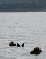
We saw our first otters in Goleta Channel outside Port Hardy this afternoon.
We’re staying in Clam Cove tonight. It sits on the NE side of Nigei Island opposite Port Alexander. The entry looks daunting, but we had plenty of water all the way in. The inner cove includes several floating homes – a very interesting and protected anchorage.

I hooked up and ran the generator for hot water for showers tonight, because… it was time. It takes about 20 minutes to heat up 2.5 gallons of water – enough for one quick warm shower.
Looking to make a straight run across the Queen Charlotte Strait and around Cape Caution in the morning.

Spoiler alert - we crossed Queen Charlotte this morning and are in Shearwater. Will post more later today.

Les and Kel
 
Wednesday, June 16, 2021
Clam Cove to Shearwater

Distance today: 102
Motor hours today: 7.3

We woke at 4:30 and were moving from the anchorage at 5:00. No cell connection at this harbor, so listened a couple times to the weather broadcast on VHF and didn’t hear any new or different info. Observations at Pine Island and Egg Island seemed pretty tame, and the West Sea Otter buoy indicated waves less than a meter, so we headed out of Clam Cove through lots of debris in the entrance.

We entered Gordon Channel, pointed toward Pine Island, and pushed up the power to start our run across the smooth water toward Cape Caution. Almost immediately, the engine overheat warning sounded (YIKES!!). I stopped the motor and went back to investigate. In retrospect, perhaps I should have left the motor idling for another 20 seconds to verify the motor wasn’t “peeing” rather than assuming that was the issue. There was one of those long snake-like weeds wrapped around the prop and some other debris at least partially blocking the cooling intake screens. After cleaning everything off, restarting the engine, and verifying the cooling stream, we ran at lower RPM for a few minutes without issue. I tentatively pushed the power up again, and the motor responded fine. It hummed along without hesitation for the next several hours at 4200-4400 rpm as we crossed the strait and made our way up Fitz Hugh Sound. As background, we generally tilt the motor up at night to limit the chance of snagging something at anchorage. We verify everything’s clear before tilting it down and starting each day.

With winds still light out of the south and southeast, along with the beginning of the ebb tide, the run to Cape Caution was fairly smooth – mainly light chop on top of some low swells. We rounded Cape Caution at 7:00, where the ride became smoother. Fitz Hugh Sound was choppy until we passed Burke Channel. It was only 11:00 when we arrived at the cut-off to my planned anchorage at Codville Lagoon, and Kel suggested we continue farther. We arrived in Shearwater about noon, got some more gas and water, and anchored in the adjacent bay where we there’s good cell coverage and we can satisfy our electronics habit.

By the way, what’s the appropriate name for that creepy top-of-the water plant that looks like an eyeball on top of the water, has a long, snakelike body, and in some cases, a leafy, beard-like section that extends deeper below the water? I want to call it eelgrass, but I know it’s not that. I had a big one wrapped around the anchor when we retrieved it this morning, and the snakey section of one wrapped around the prop when the overheat warning went off.

Thanks to everyone for your generously sharing your encouragement, wisdom, and recommendations with us. We really look forward to (hopefuly) being able to take a more leisurely return through BC in a couple months, as it feels like we’re missing a great deal by just “passing expeditiously through”.

Les and Kel
 
Rich and Judy,
I understand your disappointment with the effect of Covid travel constraints for Canadians - I question the "fairness" of it. The folks I've talked to in marinas along the way made similar comments. They seem convinced that everything will open up at the end of this month. I hope they're right.

Les
 
Good going guys! Getting across Queen Charlotte and rounding Cape Caution is a big deal! We loved Shearwater - burgers and fries in the restaurant, laundry, and a shower! Hope your can keep us posted! I am guessing no more internet until you get to Prince Ruppert.
 
LesR":1p058csv said:
Wednesday, June 16, 2021
Clam Cove to Shearwater

. . .

By the way, what’s the appropriate name for that creepy top-of-the water plant that looks like an eyeball on top of the water, has a long, snakelike body, and in some cases, a leafy, beard-like section that extends deeper below the water? I want to call it eelgrass, but I know it’s not that. I had a big one wrapped around the anchor when we retrieved it this morning, and the snakey section of one wrapped around the prop when the overheat warning went off. . .

Sounds like Bull Kelp. Charts will sometimes show known forests of kelp. It's important for lots of sea critters, but can be a real PITA for a propeller. Good idea to avoid it if you can. The stuff anchors itself, but can drift around.

I'm enjoying following your adventures. Thanks for posting.
 
". . . . By the way, what’s the appropriate name for that creepy top-of-the water plant that looks like an eyeball on top of the water, has a long, snakelike body, and in some cases, a leafy, beard-like section that extends deeper below the water?"

Yes, Les, it is "Bull Kelp" or just plain kelp. The bull part of the name might come from the long tapered tubular part that looks like a bull whip. That leafy head is kelp seaweed and you can eat it. You can buy it, dried, in the Oriental food section of your grocery store for about what you are paying for a gallon of gas. And, you can anchor in it, even without an anchor. But that is a bit scary. It will definitely calm the water down if the patch is big enough.

From right next to Nigil Island.
0_God_s_Pocket_Anchorage.sized.jpg

Harvey
SleepyC :moon

JC_Lately_SleepyC_Flat_Blue_070.thumb.jpg
 
Keep the details coming! newbie taking notes... anchorage and conditions details are extremely valuable for us future cruisers. much appreciated.

stay safe out there
 
Thursday, June 17, 2021
Shearwater to Khutze Inlet Anchorage

Miles today: 80
Motor hours today: 8.7

We luxuriated by fixing breakfast before departing the harbor at Shearwater, and started cruising at 5:45. The next section of the Inside Passage that’s sort of open to the ocean is a relatively short crossing of Milbank Sound. We hit the sound at 14 knots at 7:00. There were some pronounced swells and sections of chop. As we turned west and northwest, the swells hit us on the beam and made the ride busier. The swells and chop continued until we were well into Finlayson Channel. I’m thankful we didn’t make the run later in the day. It’s also scary how debris and large logs can disappear in the swells, especially given how low we sit to the water.

We passed a few fishing boats in Milbank Sound, then they passed us again once we slowed down in Tolmie Channel north of Klemtu. It started raining in earnest in Tolmie Channel and continued except for short periods through the remainder of the day. We arrived at our planned anchorage in Khutze Inlet at 2:45. Wow, what a beautiful setting (I’m sure this will become an overused description) – steep mountains on both sides, a snowcapped peak at the head of the inlet, and a waterfall running from the mountaintop to the water just across the inlet from our anchorage.

We dropped the anchor in a little nook in 50 feet of water about a mile inside the entrance. The two other larger cruisers who checked in after us in Sidney pulled in an hour after us and anchored a little farther into the inlet. Despite the rain, we grilled chicken for dinner. The produce and meat we got from the IGA in Port McNeill two days ago has been excellent. They get a shipment only once a week, and our delivery was “late” in the week, so we have been quite pleased.

We have about 120 miles remaining to Prince Rupert, and we’ll probably keep that as a two-day run. As of yesterday, it looked as it the weather for crossing the Dixon Entrance will be more favorable on Sunday than Saturday, so pushing to get to Prince Rupert tomorrow may not be beneficial.

Friday, June 18, 2021
Khutze Inlet to Baker Inlet

Miles today: 83
Motor hours today: 12.2

We struggled to get up early, but left the anchorage about 5:45 and made breakfast once underway. We had very smooth water all day, so slow cruised and enjoyed the scenery. While I enjoy eating up miles at speed, cruising at slower speeds makes it easier to note and avoid logs and other debris in the water that could ruin one’s day.

We made a quick turn into the inlet at Butedale. It looks as if several of the buildings I remember from older photos have been razed.

We saw our first whale of the journey in McKay Reach just before entering Wright Sound. We saw the spout in the distance, then it dove right after. We had a few short moments of cell service as we passed south of Hartley Bay, and I dutifully made my ArriveCAN “daily report from quarantine”.

Midway through the Grenville Channel, we met BC Ferries Northern Adventure heading southbound. People pay good money for the thrill ride we got crossing her wake.

We decided to spend the night in Baker Inlet, which is a beautiful and remote body of water separated from Grenville Channel by Watts Narrows. Waggoner Cruising Guide indicated the narrows could probably be transited with current (i.e. not during slack). We were midway through the flood tide when we passed through the windy, quarter-mile narrows. There was a little sporty rapids as the narrows flushed us into Baker Inlet, but no other situation that compromised directional control.

Tonight was shower night. Unfortunately, the shower sump failed midway through the process, resulting in a few gallons of water under the cabin step and on the cabin floor (Argh!!). Water draining from the shower passes though a hose under the cabin step, which leads to a sump box and pump under the cabinet on the opposite side of the boat. As water fills the box, a float switch triggers the pump to expel the water from the side of the boat – at least that’s the way it’s supposed to work. Something to troubleshoot when we have a spare day in a marina.

Les and Kel

Butedale today
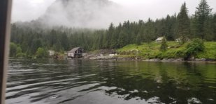
Butedale.sized.jpg
 
Saturday, June 19, 2021
Baker Inlet to Prince Rupert

Distance today: 46
Motor Hours today: 6.2

A gentle rain serenaded us for most of the night, but stopped by the time we woke up. With a little over 40 miles to travel today, we didn’t need to hurry. The flood tide was in full force at 6:00am, and I wanted to wait until closer to slack to transit Watts Narrows on the way out. We left at 7:45; we had some current to overcome on the way out, but less than when we arrived yesterday. For the first hour Grenville Channel was choppy, likely because the wind opposite the still-incoming tide.

After entering the Arthur Passage along the west side of Kennedy Island, the ride smoothed and we had a nice ride the rest of the way to Prince Rupert. We noticed an interesting barge chain leaving Prince Rupert today. One tug was pulling a barge with a large 2-story building that looked like it could be motel. The other tug with it was towing two barges, each with smaller buildings. Towed behind the two smaller buildings were about a dozen center-console fishing boats. Can anyone explain what this is? I assume it’s something like a mobile fish camp being pre-positioned for the season. I’ll hunt down a picture and add it later.

We arrived in Prince Rupert by 1:00, quickly refilled gas and water, and anchored in Pillsbury Cove across from the harbor, where we have decent cell connectivity. A fairly open anchorage and a little breezy this afternoon, but will make a good starting point for our planned run to Ketchikan tomorrow. As of now the weather still looks favorable for tomorrow, after which the stronger northwesterly winds pick up for the next few days.

A note for the C-Brat readers: since Kel and I (Les) combine the content of these posts with her blog (links below in the signature line), I will regularly make comments to explain concepts to non-boaters. Please don't assume I am providing instruction to the C-Brat audience. Since we acquired Intuition 11 years ago, everything I’ve learned about C-Dories and most of what I’ve learned about prudent seamanship (save those learned from my errors) have come from this site. We are incredibly indebted to everyone who generously shares their store of knowledge and expertise; your accounts from prior adventures, instruction, and encouragement have enabled us on this journey.

Les and Kel Rohlf

otters.sized.jpg
 
Except for the shower sump/pump failure, sounds like you both are having the trip of a lifetime. Thank you for the details in travel. Many, including us are watching and learning from your adventure and experience in your travel.
 
Great story and postings. Love to hear about how things have changed in the last 30 years!!

Most likely the "buildings" you saw on the barges are a logging camp. These are take to extremely remote areas. They are basically a self contained city for the loggers. It could also be for a construction crew.

I believe that most of the fishing resorts are well established. You will see more of them in AK--but because of the COVID missed those in BC, which of which are very worthwhile visiting.
 
Les,

You are putting some good hours on your main. What are your plans for an oil change in your travel? Will you change your own oil using an oil extraction pump or do you have a scheduled plan for another to do the service? Thanks. Gary.
 
" . . . . A note for the C-Brat readers: since Kel and I (Les) combine the content of these posts with her blog (links below in the signature line), I will regularly make comments to explain concepts to non-boaters. Please don't assume I am providing instruction to the C-Brat audience. Since we acquired Intuition 11 years ago, everything I’ve learned about C-Dories and most of what I’ve learned about prudent seamanship (save those learned from my errors) have come from this site. We are incredibly indebted to everyone who generously shares their store of knowledge and expertise; your accounts from prior adventures, instruction, and encouragement have enabled us on this journey."

Les, You are doing great. Thanks for adding the links in your signature line. I wee you are posting the daily mileage. Do you also keep track of your total miles? For some of us that are not mathematicians, any chance of including that total in your posts? Seems like you got to Prince Rupert really quick. So far no bad weather days. (Note, rain is not a bad weather day, it is ordinary weather, unless it is raining sideways :shock:

The 2 tugs sound like you are right, they are moving a summer fish camp. More safe for the camp and more efficient than having someone live at the camp year around probably.

I have left some notes on Kel's blog site. Are you able to see those? Just curious.

Thanks for the great notes on your mission. Greatly enjoyed here.

Harvey
SleepyC :moon

IMGP1872.thumb.jpg
 
Just a quick update - we made it to Ketchikan today after a pretty smooth crossing. We'll be here at the Bar Harbor South basin for a few days. More details tonight or tomorrow.

Les and Kel
 
Harvey,
Yes, Kel read your comments to her blog, so we can see them. Thanks for your notes and suggestions! I'll add totals and averages to the post from yesterday.

You noted the large Chock-Cleats on our bow. I got them several years ago and really like them:
https://newfoundmetals.com/product/cleat-chocks/
I typically use them as chocks when anchoring or tying off to a dock, passing the line through and tying to the center bow cleat. They work OK as a cleat as well.


Gary,
I talked with the Honda service dealer in Auke Bay before leaving and again today. I'm working toward having the motor serviced in mid-July at Auke Bay. He indicated he can probably pull the boat and take care of it within a day. I figure I will have added 300-400 hours on the motor with this trip. My hope is to do an oil and filter change at roughly the mid-point and have my usual mechanic in St. Louis do a thorough service (to include thermostats) after returning.

Les
 
Sunday, June 20, 2021
Prince Rupert, BC to Ketchikan, AK

Distance today: 95 statute miles
Cumulative since Everett: 799 statute miles
Motor hours today: 8

We awoke at 4:00 to check the latest weather forecasts and reports. Every nearby wave height indicator was “2 feet or less” or “1 meter or less”. The Central Dixon Entrance Buoy showed 1.3 feet, as low as I’ve seen it in a while. Winds were forecast for light and variable as they shift toward the northwest later today. We were moving away from our anchorage in Pillsbury Cove shortly before 5:00 and took our time following the Venn Passage out to Chatham Sound. The passage wasn’t bad – it was near low tide, and we never saw less than 13 feet. We took the north route around Tugwell Island, which some guides imply should be run at or near high tide, and we saw no less than 20 feet through that section.

Chatham Sound proved to be very smooth. We picked up increasing chop as we approached Dundas and Green Islands, but that subsided north of Dundas, where we experienced smooth swells with long periods. We maintained 15-17mph throughout the crossing, and arrived in Ketchikan by 11:00 Alaska time. We stopped for gas on the way into the harbor and were assigned a slip in Bar Harbor South basin. We noted something was amiss when we arrived in Ketchikan… it was sunny and clear! I am told this issue will be resolved within the next day.

After 9 days since leaving Roche Harbor and not being able to walk farther than the length of a fuel dock, we were in dire need of real showers and clean laundry. With those priorities taken care of, we had a nice meal at the nearby Ocean View Restaurant (Mexican, Italian, and Greek food). It’s both satisfying and relieving to have completed this section of our trip. We’re now free to divert to places as we choose and to travel as short a distance as we want each day.

It looks as if there’s a nasty storm coming in Wednesday and Thursday, so we will likely stay put until it passes.

Trip Summary for Everett to Ketchikan
Total (statute) miles 799
Total days: 12
Days from Roche Harbor to Ketchikan: 9
Gas used: 269 gallons
Cumulative mpg: 2.97

Note: My mileage stats are in statute miles, as that’s how my chartplotters are configured. I’ve always had them set that way, since nearly all of our previous cruising has been on inland lakes and rivers, where distances are charted in statute, rather than nautical miles.

Kel and Les Rohlf

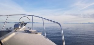
Chatham Strait at 6:00
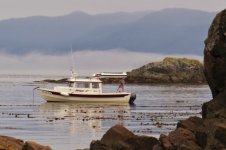
Chatham_Sound.sized.jpg

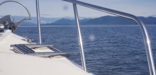
Revillagigedo Channel at Mary Island
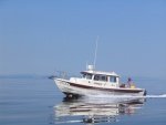
Revillagigedo_Channel.sized.jpg

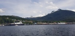
Ketchikan Downtown (no big cruise ships this year - yet)
Ketchikan_Downtown.sized.jpg
 
Thanks for the new post Les, and for the "Cleat Chock" info. I forgot they were called cleat chocks and tried looking them up under chock cleats. Got some interesting responses, even some edible ones :oops: Are yours the 10" version? They do look hefty enough. I saw them in PT several years ago but not in stainless or chrome, just bronze I think, so didn't go, but those look really nice. "C-Dory-ish"

You did pretty close to 90 miles a day. That is pretty good, and not having to take a weather day helps. especially if it had been in Canada this year.

Just saw that the border is going to remain closed until July 21 at least. Hard to say what happens after that.

Take care and enjoy your walks now.

Harvey
SleepyC:moon

7_SleepyC_at_Port_Harvey_001.thumb.jpg
 
LesR":2v9eprca said:
Thursday, June 17, 2021
Shearwater to Khutze Inlet Anchorage


We luxuriated by fixing breakfast before departing the harbor at Shearwater, and started cruising at 5:45. The next section of the Inside Passage that’s sort of open to the ocean is a relatively short crossing of Milbank Sound.

Les and Kel

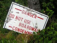
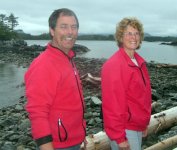
If you had looked up while crossing Milbank Sound, you might have seen the Ivory Island Lighthouse! The keepers of the lighthouse, Brent and Sylvia Hacking, wanted to get a C-Dory and had been following our progress on C-Brats, and invited us to stop at the lighthouse. They guided us to a cove behind Ivory Island and directed us up to the lighthouse via a boardwalk. There was a "Boardwalk condemned, do not use" sign along the way!

dwalk_Condemned_sign_at_Ivory_Island_6_14_06.sized.jpg

It was a fascinating and memorable visit for us!

Article about Ivory Island Lighthouse in Milbank Sound.

Brent and Slyvia Hacking, light keepers of Ivory Island Lighthouse, June 14, 2006.
eepers_of_Ivory_Island_Light_Station_6_14_06.sized.jpg

We later learned that Sylvia had become the first female lightkeeper in Canada!
 
Back
Top