Intuition to Alaska - 2021

We noted something was amiss when we arrived in Ketchikan… it was sunny and clear! I am told this issue will be resolved within the next day.
My first time in Alaska was many, many years ago on a business trip (all travel on that trip was by airplane). My only time in Ketchikan was on that trip when I spent 3 hours in the airport waiting for a connection.

I clearly remember looking out the windows as rain and wind created rivulets streaking down the windows. I chatted up a local, and in the course of small talk, I asked with curiously: "So, how much rain do you guys get here in a year, anyway?" His answer stunned me: "......oh, about 13 feet".

I had never heard anyone quote rain stats in feet before. It simply never occurred to me. We had a good laugh over that.
 
Les and Kel,

We are enjoying your adventures and posts! You guys have REALLY researched the details.

Keep posting as we follow along in envy, if not in your wake. Your grit and determination on your cruise is admirable. You guys really blazed some trails in the pandemic, despite a bunch of pessimists like me regarding your likely success in bumping and grinding rubrails up against not just one bureaucratic 'gubment', but two. What's the odds, Eh?

Safe travels, and hope to see you again in March at the Hontoon hoot! We'll want to hear your stories!

John and Eileen
 
June 21-24, 2021
Ketchikan

As of late afternoon on Wednesday, June 23, order has returned to the universe, and it’s raining in Ketchikan. We’ve enjoyed the last few days of dry weather to relax and explore a little. While we’ve been relaxing, there’s a continual hum of activity here at the Bar Harbor South Basin with fishing boats arriving or departing. We’re in between two floatplane zones, so we see and hear the regular departures from the north zone and approaches to the south zone just over the basin’s break wall. The Ketchikan airport is on Gravina Island and across the channel from us, so we also see the commercial airline arrival/departures.

We walked the 2 miles to downtown on Monday, wandered through a few shops, and had good burgers at the 108 Tap Room. The downtown area where cruise ships normally dock has obviously been hurt by their absence this year and last. It’s nice for us to be able to wander without fighting the crowds, but I hurt for everyone here who relies on tourism for their livelihood. The young lady running the nearby coffee shop indicated she’d otherwise be leading tour groups.

After spending a little time here, I’m glad we were assigned a spot at Bar Harbor South Basin. There are three main public Marinas in Ketchikan proper: Thomas Basin, Casey Moran, and Bar Harbor. Thomas Basin sits at the mouth of Ketchikan Creek adjacent to downtown; Casey Moran is a short distance north and is tucked behind one of the cruise ship berths. While close to downtown, I don’t believe these marinas offer nearby shower or laundry facilities. Bar Harbor, about 1.5 miles north of downtown, includes showers at the Harbor Office (North Basin) and a laundry adjacent to the South Basin. The Safeway is just a couple blocks south of Bar Harbor as well. Visiting the downtown area is not difficult either by walking, taxi, or public bus. One minor negative about the Bar Harbor men’s restroom – it includes only a single sit-down toilet. In a large marina like this one, it’s an in-demand property most mornings.

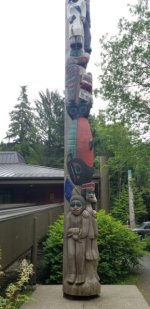
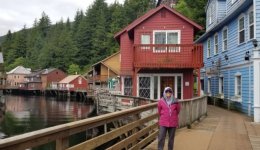
On Tuesday we caught the bus and visited the Totem Heritage Center. They have an excellent museum showcasing several totems preserved from the late 19th and early 20th centuries. From there, we followed the creek down the hill and walked through historic “Creek Street” to its end at Thomas Basin. We had an excellent lunch (Halibut Fish and Chips and Kebab Platter) at the New York Café. Kel has also identified and thoroughly scoured the three thrift stores in town.

Totem Heritage Center
Totem_Heritage_Center.sized.jpg

Creek Street
Kel_Creek_Street.sized.jpg

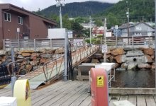
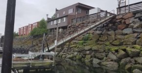
Today (Thursday) is one of big tidal extremes. The low tide this morning was -3.8 feet, after last night’s high of 18.2 feet. A very low tide creates an extreme angle to the walkway from the floating docks up to street level. It’s a good workout for your quads going up, and a rather harrowing experience coming down.

High Tide
High_tide_Ketchikan.sized.jpg

Low Tide
Low_tide_Ketchikan.sized.jpg

Assuming the wind and waves in Chatham Strait dissipate overnight, we’ll leave tomorrow to head toward Wrangell. Our plan is to stop at the Anan Bay Wildlife (Bear) Observatory on our way. They don’t require permits to visit until July 5, though I’m not sure how much activity with the salmon run happens before then.

Les and Kel Rohlf
 
One recommendation I have before you leave Ketchikan. Go into that hardware store near Safeway, and buy a collapsable crab pot, line and float. The Alaska license is a bit pricey for us out of staters, but Dungeness Crab taste great! And you can drop the pot overnight when you arrive to your anchorage, and pick it up in the morning. Just find out from locals where the best crabbing is, or drop it among (but out of the way) from the commercial pots. And if you get the license, you can enjoy some regular fishing while killing time somewhere. Colby
 
That is nearly a 23 foot tide. A bunch of water, and yes a big climb up the ramp. Where does all that go when it isn't there?

Harvey
SleepyC :moon

9_Sept_Seq_2019_Cal.thumb.jpg
 
Friday, June 25, 2021
Ketchikan to Santa Anna Inlet

Mileage today: 65
Cumulative mileage: 864
Motor time today: 8.5 hours
Motor hours: 971.5

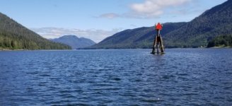
We left Ketchikan at 5:00 in fog and a light mist. We cooked breakfast while slowly making our way north out of Tongass Narrows toward the entry to Clarence Strait. The weather indicated waves “2 feet or less” in Clarence Strait, and my backup plan was to duck into Knudson Harbor or one of the other anchorages just inside the Behm Canal if things looked too dicey.

The water was just choppy as we passed Guard Island, so we ran fast across the Behm Canal entrance and part way up the west side of Cleveland Peninsula toward Meyers Chuck. It was a bit of a busy ride – winds and swells out of the southwest resulted in following waves on the port beam. We slowed approaching Meyers Chuck, and the water calmed dramatically as we neared the turn to Ernest Sound.

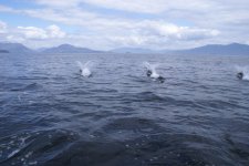
While running at 8mph in Clarence Strait, a pod of Dalls Porpoises (I think) appeared and surfed our bow wave. That’s really not a good description – they appeared alongside or at our bow and zipped by as if to taunt us for going so slow. It was quite a show, lasting for 3 or 4 minutes before they disappeared.

My preliminary anchorage plan was Vixen Cove, a small nook on the southeast side of Union Point. It’s a good example of misleading information in the charts – my charting software shows the wider opening around the south side of the rock which guards the entrance. In fact (as shown in the Douglass guide), the better passage is around the north side of the rock. As we lined up for the entrance, I lost my nerve. It was near low tide (-4’ this morning), and I wasn’t convinced there was suitable depth in the very narrow channel. Had we been closer to high tide with 10 or more additional feet of depth, it would not have seemed as perilous.

It was still early in the day, so we continued our leisurely cruise up Ernest Sound and pulled into Santa Anna Inlet about 1:30pm, shortly before high tide. We went the mile to the head of the inlet and anchored in 60’ of water. Around the edges, the bottom rapidly shallowed to less than 20 feet, which would not have provided much buffer for tonight’s low tide. As we set the anchor the first time, the back of the boat was over that shallow area, so we pulled it and dropped the anchor closer to the center of the inlet. We had a very picturesque site at the head of the bay just opposite a waterfall that provided a soothing rush of sound.

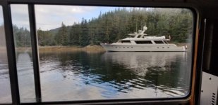
Another larger cruiser (aren’t they all?) pulled in after us to share the inlet. Then at 7:30 the 110-foot motor vessel Dulcinea (Newport Beach, CA) pulled into the inlet and motored past both of the anchored boats to put out crab/shrimp pots at the very head of the inlet. They then motored back between the two of us and anchored. He did so deftly, but it seemed like an awfully large boat to fit into the small area I left between our anchor and the drying flat at the head of the bay.

View from the kitchen window:
Dulcinea.sized.jpg
 
Saturday, June 26, 2021
Santa Anna Inlet to Madan Bay

Distance today: 39 miles
Cumulative distance: 903 miles

Motor hours: 978.5
Motor hours today: 7

We didn’t have a long distance planned for today, and I wanted to arrive at Anan Bay after low tide, so we ate a leisurely breakfast and left the anchorage at 6:30. Since the holding is reportedly poor at Anan Bay, I wanted to anchor early in the rising tide, so that both the incoming tide and northwest winds would hold the boat in the same relative spot while we were away. A changing tide or winds might turn the boat and cause the anchor to release or drag.

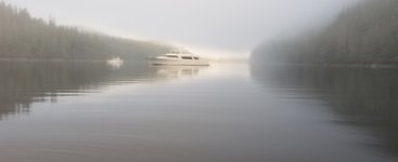
Morning in Santa Anna Inlet
Santa_Anna_Bay_morning.sized.jpg

Dulcinea caught up with us as we pulled into Anan Bay, but she just made a slow circuit and departed up the Blake Channel toward Wrangell. Today’s exercise involved launching our new dinghy and motor from the boat for the first time. Embarking went fine until we needed to secure it at the beach landing. We left it barely floating and stuck the cheesy grapple-style dinghy anchor in the mud on its 25’ line and tied another 25’ line around a rock to secure it. In the 5 minutes we debated whether this would be sufficient and where the path to the observation area started, the rising tide had covered both lines. Plan B: I removed the Torqeedo motor and carried it to a point above the high-water mark, after which we carried the tender up to a point just short of the high-water mark. This proved sufficient for the one hour we were away.

There are two trail routes to the Anan Creek observation area: one involves a half-mile trail that starts at the Forest Service cabin and winds around the ridge; the other is a spot on the creek that meets the first path near the observation area. A work boat was parked there – I suspect there may not be enough depth in the creek to get to that spot from the bay during low tides, and the current may require a pretty powerful dinghy to make it upstream against the creek’s current. We hiked the first path and arrived at the observation area above the creek to see a crew working alongside the creek with a backhoe. We did see a mink scamper along the creek, but no bears.

When we returned, to our tender we were met by Bruce, who with his family were spending a couple nights in the Forest Service cabin. H seemed to think the Pink Salmon that returned to this creek to spawn would not start returning until later in July.

We managed to get the tender re-loaded to the cabin top without damage to it or ourselves. Next investment – a lifting Davit to facilitate the process. We left Anan Bay and tuned north up the Blake channel. We got a nice boost with the tide, but it was a wet ride with brisk northwest winds opposing the tide and creating choppy waves. Our planned anchorage for today was Berg Bay, which is a stunning setting with a snowcapped mountain rising directly above it and another high ridge to the east. The greeting committee for Berg Bay were horseflies, who surrounded the boat and made every effort to gain entry to the cabin. Since I planned to grill this evening, I didn’t want their help, so we made a circuit of the bay and moved on toward Madan Bay. We anchored near the head of Madan Bay. It’s still breezy, as there’s only a treeline to shield us from the northwest wind, rather than higher terrain. The wind calmed later and we had a quiet, restful night.

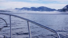
Reconsidering my choice to leave the radar off on a clear and sunny day:
Fog_on_Ernest_Sound.sized.jpg

Kel and Les Rohlf
 
Sunday, June 27, 2021
Madan Bay to Wrangell Heritage Marina

Distance today: 18 miles
Cumulative distance: 921 miles

Motor hours: 982.0
Motor hours today: 3.5

We had less than 20 miles remaining to today’s destination at Wrangell, so we slept in a little and ate a relaxed breakfast. While retrieving the anchor, a section of our rode jammed in the windlass. No amount of tugging from above or below would dislodge it. I opened up my PC to pull up a copy of the manual, so that I’d have a better idea of how to partially disassemble it; unfortunately, the windlass manual seems to be the only one I did not download to my PC before leaving St. Louis. Realizing I wouldn’t have an internet connection until we arrived in Wrangell, I pulled up the rest of the rode and anchor the old-fashion way and left it sitting in a pile on the deck for our trip to Wrangell.

The cruise up the rest of the Eastern Passage was smooth, and we turned around the northern tip of Wrangell Island toward the town of Wrangell. We were told by the harbor master to go the Heritage Marina about a mile south of town. It’s the newer basin where they seem to put transients, and includes a long side-tie transient dock with 30- and 50-amp power stations. Unfortunately, they’re locked, so we called the harbor master, who promised to leave some paperwork and unlock the power post this afternoon. We’re sharing the transient dock with just one other boat tonight.

Once docked, I set about downloading the (not very good, IMO) documentation from Lewmar for my windlass. After analyzing the exploded view and instructions for removing the gypsy, I grabbed a couple tools and headed (with great trepidation) to the bow to start surgery. I’ve dropped enough tools and small bits into the water in my short time as a boater to view this as a high-risk operation. Not only am I not terribly familiar with the inner workings of my windlass, but losing a small part to Davy Jones’ Locker would make it that much worse. Kel sat in the cabin and held each part as I removed it. Apparently a section of the line (perhaps a twisted, rather than straight section) jammed and got mangled between the gypsy and rope guard, instead of falling into the anchor locker. Two of the strands were mangled pretty badly, so I didn’t have much confidence in the integrity of the line. The mangled section was a little more than 100 feet into my 300 feet of line, so cutting and using the remainder of the line was not my preferred approach. I have two shorter backup rodes, but both only have 20’ of chain, so I wanted to stick with my primary that has 50’. I called the Sentry Hardware in Wrangell, and they had 300’ of ½” 3-strand nylon line available.

Kel and I headed toward downtown Wrangell to get rope and ice. On the way, we passed a garage sale, whereupon I (Les) roll my eyes while Kel checks it out. Fortuitously, they had a basket-style cart for $5. This would be cheaper than a cab ride back once we were loaded down with ice and 300 feet of line. We picked up the line for a very reasonable price, grabbed two bags of ice across the street at the City Market, and headed back to the Marina.

Some of our St. Louis weather has followed us to Alaska. It was almost 80 degrees in Wrangell today and expected to be as warm tomorrow. We’ll stay here in Wrangell for at least another day – it usually only takes me several hours to execute an ugly 3-strand to chain splice. I know they’re not supposed to be that difficult, but mine never seem to look quite as tidy as those in online tutorials.

Kel and Les Rohlf
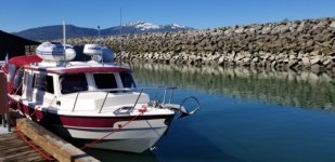

Wrangell_Dock.sized.jpg
 
LesR":cabpb61l said:
Friday, June 25, 2021
Ketchikan to Santa Anna Inlet

. . .We slowed approaching Meyers Chuck, and the water calmed dramatically as we neared the turn to Ernest Sound.

While running at 8mph in Clarence Strait, a pod of Dalls Porpoises (I think) appeared and surfed our bow wave. That’s really not a good description – they appeared alongside or at our bow and zipped by as if to taunt us for going so slow. It was quite a show, lasting for 3 or 4 minutes before they disappeared . . .

I've done this stretch a half dozen times, and invariably I've encountered Dall's Porpoises. If what you saw threw a double rooster tail, they were Dall's. Here's a picture of a few of a larger group we saw in Ernest Sound on one of our trips.

DSC06413.jpg

I am getting the biggest kick following your trip. Thanks again for posting!
 
I am really enjoying your posts! Thank you. Brings back a lot of memories. As for bears, if you can get a permit for Pack Creek, (At Juneau, Tongrass National Forrest Headquarters--not sure of current process), but that is the best bear watching in SE AK. (We did see bears at Anan Creek. 2 were at the falls, and one on the trail, when we were headed back down... All were black bears. It was also one of our first experiences of anchoring a 375# RIB (including outboard, fuel tanks, battery etc). We eventually found that putting an anchor out well, with a pulley at the end of the chain, and an "Endless line" from the bow of the inflatable to the beach, and then to the stern of the inflatable. We would tie the line above the height of the highest tide, and pull the inflatable out off the beach, beyond any surf or low water mark.)

Thanks again, for the ride along for all of us!
 
Thanks for the ride. Love it and Kel's musings, especially about God's Pocket. Interesting thing about the windlass. Let us know what you find and if you can figure a why.

Harvey
SleepyC :moon

JC_Lately_SleepyC_Flat_Blue_070.thumb.jpg
 
Monday and Tuesday, June 28-29, 2021
Wrangell

With warm, sunny days in the forecast, we decided to devote Monday morning to boat cleaning. There’s only one other empty boat on the transient dock, so we decided to take advantage of the opportunity. We pulled the pool mat and dri-dek from the cabin floor and sprayed it off and let it dry. Then we did the same for the cockpit, spreading out all of our possessions stowed there while we cleaned the pool mat and the cockpit floor proper. I’m sure we looked a little like the Clampetts doing spring cleaning, but we weren’t in anyone’s way and were uncertain when we’d have another day in port with weather this nice.

In the evening I worked to splice my new line to the anchor chain. I was in no position to be picky about the quality of this line, but it sure feels soft and kink-free. It ran smoothly through the windlass when we re-loaded the rode today. I believe our problem with the last rope was that it had a kink that didn’t release from the gypsy and fall smoothly into the anchor locker. When the windlass seemed to “labor” Sunday morning, we stopped the retrieval while I checked tension on the anchor side of the rode. When I noted it was slack, I had Kel continue to retrieve. What I should have assumed is that since the rode was not under tension, the windlass’ stress was due to resistance within the windlass and to at least momentarily reverse direction to (hopefully) resolve whatever was causing the resistance. Instead, attempting to continue to retrieve the rode worsened the jammed line.

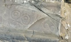
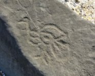
Today we re-loaded the rode, then headed toward Wrangell for some non-boating adventures. We walked north of town to Petroglyph Beach State Historical Site, which was quite cool. We finished wandering the beach by ourselves searching for petroglyphs just before three tour buses arrived. We walked back to town and had lunch at the “Queen’s Booth”, an outdoor breakfast/lunch spot which raises funds for the Wrangell’s July 4 extravaganza. We then went to the laundromat for showers before backtracking to the Wrangell Museum and City Market. The museum located at the civic center provides an excellent history of settlements in Southeast Alaska and Wrangell in particular.

The weather looks good tomorrow for the run across Sumner Strait to the Wrangell Narrows and north to Petersburg. We expect to stay there through July 3, with a possible out-and-back to Le Conte Glacier during that time.

Kel and Les Rohlf

Petroglyphs1.sized.jpg

petroglyphs2.sized.jpg
 
Thanks everyone for your continued encouragement. We're enjoying sharing what has been a new and exciting adventure.

Harvey, the cleat chocks I installed were the 8" version.

John, I kept waiting for someone official to find a reason to say "No" to this trip. We're thankful the process has been as smooth as it has. Fortunately there are a number of people who have successfully done this - we continue to meet folks here who have made the transit ahead of us.

Bob, thanks for the recommendation regarding a process for anchoring the dinghy. I remember previously reading something similar (probably from you) but having experienced the issues firsthand, I now see the value in that setup.
 
I love that museum in Wrangell. Is the giant, scary-looking vintage two-man chainsaw still there? What a beast!

When you get to Petersburg, be sure to have at least one meal at the Salty Pantry. Also check out the 126# salmon in the museum. If your are up to it, the hike up to Raven's Roost (other side of the airport) is well worth the effort, especially if the weather is clear. The trail is recently upgraded, and the climb is much easier than it used to be. The trip to Le Conte is a must.

Careful through the Narrows!
 
Les, thanks for the info on the "Choc-letes" I could never find them on the internet, now I know why. They seem good sized.

By all means, take advantage when you can. On my 100 day trip, I had 48 days of consecutive rain. (Not all day every day, but rain for at least half a day, and that gets really old.) The best part of that was that at least I got a shower now and then. (That depended on where I was anchored :oops: Boy was I glad my Wallas worked when I needed it. :lol:

I think you might be right about the rode kink. Seems like that fits. That is one of the reasons I prefer to only run out to the end of my chain (70 feet).
On retrieving your anchor, you may already be doing this, but if not, it's easy and quick, with good results. When your anchor is just below the surface, back away from it, and (being sure you have plenty of room) rev up the RPMs a few times, (just a bump up for a few seconds and then back to idle, then up and down again 3 or 4 times) then continue your retrieve and you should have a nice clean and shiny anchor up there. It gets cleaned in the prop wash as you are backing.

Enjoy the warm, We had 102 here in Sequim yesterday (Monday), and Tues we dropped to high 70's with a nice ocean breeze. What a relief.

Harvey
SleepyC:moon

6_June_2017.thumb.jpg
 
Wednesday, June 30, 2021
Wrangell to Petersburg

Distance today: 46 miles
Cumulative distance: 967 miles

Motor hours: 988.5
Motor hours today: 6.5

We pushed away from the dock in Wrangell shortly before 5:00 with hopes of getting across Sumner Strait before the winds picked up. It was pretty smooth as we came around Five Mile Island and threaded our way between Vank and Sokolof Islands. The next 12 miles or so to the Wrangell Narrows entrance was a splashy but not uncomfortable ride at 8 mph.

The Wrangell Narrows is a 20+ mile winding, narrow (duh?!) channel that provides the most protected yet direct route north for all but the very large cruise ships. It’s well-marked and well-charted, but requires attention to stay in the confined deeper channel and avoid all the other vessels using this passage. AIS indicated a larger vessel (tug, I assume) entering the channel northbound ahead of us, and another very large cruiser exited southbound as we approached. We didn’t meet anything larger than small fishing boats until we neared Petersburg. There was a bit of a traffic jam of small fishing boats from the lodges near Green Point.

We left Wrangell just before high slack tide, so I expected we’d have to fight the current during the first half of the narrows. Indeed in a couple spots we paid a 4 mph penalty for this, though we had a push after passing the point at which tidal currents from each end of the narrows meet. We arrived in Petersburg shortly before low slack, which limited the amount of current we’d wrestle when docking. We’re at a slip on Float One of the North Harbor, very close to the Harbormaster Office and the compact downtown area. Tomorrow we’ll catch up on laundry and do some exploring in town.

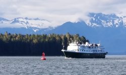
This evening we watched as the Wilderness Explorer, a smaller cruise ship, passed by Petersburg to begun its southbound passage through the Wrangell Narrows. I’m thankful we didn’t have to contend with traffic of that size during our passage.

Kel and Les

Approaching Patersburg
Wrangell_Narrows_end.sized.jpg

Wilderness Explorer
Wilderness_Explorer_Petersburg.sized.jpg
 
". . . Wrangell Narrows is a 20+ mile winding, narrow (duh?!) channel. . ."
There's where your AIS pays of handsomely. TTCA and DTCA, Time and Distance to closest. It even sees around corners -- What a blessing. That should help take some of that anxiety of meeting in narrow places. Enjoy. Oh and those cold showers, Yup, but still better than none. Loved the free hot shower. Always learning here. Thank you.

Harvey
SleepyC :moon

January_2010_344.thumb.jpg
 
When in Petersburg jig for herring at the dock near the fish factory, bofore you leave. Go up to Pybus bay. There is a ledge along the North Side--were we have always gotten good Halibut in the 40 to 60# size range. (There is a fishing lodge there, so the pickings may be a bit less.

There is a book "Salmon Holes and Halibut Hills"--good information on fishing. Unfortunately it is out of print--and you can find it very cheap--or very expensive... Keep an eye out for the book. A number of years back I donated all of my AK and PNW guides to the C Dorys--and I don't know if any of them are still flopping around or not...Harvey??
 
Yes, I still have some of them. Some have been shared, and I have gotten some back, so most of them are here. I can look and see if that book is in there.

Harvey
SleepyC :moon

0_God_s_Pocket_Anchorage.thumb.jpg
 
Back
Top