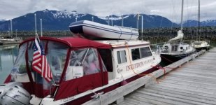
Intuition to Alaska - 2021

We have decided to let others do the fishing on this trip. All I have at home is lightweight freshwater tackle and wasn't inclined to invest in new tackle/hardware/research for just this trip. I am toying with the idea of doing a one-day guided fishing trip while we're in AK this summer. I'm open to suggestions if anyone has recommendations for a specific charter service or location.

Les
 
Friday, July 1, 2021
Petersburg out-and-back to Le Conte Glacier

Distance today: 53 miles
Cumulative distance: 1020 miles

Motor hours: 995.2
Motor hours today: 6.7

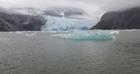
We took a day trip today to Le Conte Bay in hopes of seeing Le Conte Glacier, the southernmost tidewater glacier in North America. We met the National Geographic Venture cruise ship as she entered the narrows from Frederick Sound; we cheated slightly outside the channel to allow them room.

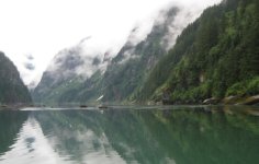
The 15 miles across Frederick Sound to the mouth of Le Conte Bay were very smooth, and we didn’t need to slow down for ice until we reached the west entrance to the bay. Low clouds limited visibility and blended with the horizon. The Douglass guide and notes from Active Captain describe the bay as tricky and treacherous, with a narrow entrance and shallow bar. This certainly makes sense for the era prior to electronic charting and GPS, though it seems much less an issue nowadays. We came in just after a 13-foot high tide and didn’t see less than 33 feet of depth across the bar. We saw only a few pieces of ice until we rounded Indian Point. The valley walls and waterfall opposite Thunder Point were beautiful as the clouds lifted just enough to see glimpses of the peaks above.

We saw a larger boat, Northern Song, ahead of us. This is an 84-foot steel-hull charter expedition yacht with 4 cabins and room for 9 guests. They stayed ahead of us as we rounded the last point to see the face of the glacier. Though I’ve seen lots of pictures, it’s hard to describe the enormity as we saw the glacier face firsthand. We were able to get within a mile of the glacier before I got less than comfortable with the amount of ice. Northern Song and a tour boat from Petersburg that arrived after us continued to a point about a half mile closer. We hung around for 30-40 minutes and saw the glacier calve a couple times. We saw a few seals on the ice, though a local I talked with later said they are usually thick in the bay. All in all, a very awe-inspiring experience for our first glacier.

We had another very flat run across the sound on our return to Petersburg, as the clouds cleared to a sunny and comfortable afternoon. For dinner we joined Ron and Michele Hall and their friends Jeff and Susie. Ron originally owned Viking Lady, a CD-25 that I remember from earlier promotional material. Both couples now own Krogens which they keep in Alaska. We had a very good dinner at Inga’s Alley, which now serves Thai in addition to fish and burgers. We’ll stay in Petersburg through tomorrow to watch fireworks and then head up toward Juneau beginning Sunday.

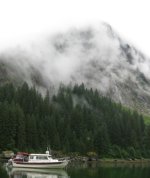
Le Conte Bay
Le_Conte_Bay_Waterfall.sized.jpg

Le Conte Glacier with Northern Song in front of glacier
Le_Conte_Glacier.sized.jpg

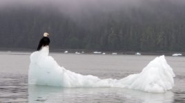
Eagle_on_Ice.sized.jpg
 
Hi Les and Kel, glad you guys got in there to see the glacier. When I was there, we stayed in that little cove/bay just across from the entrance to Le Conte for two nights, making the run into the glacier in between. When we were there, the ice was pretty thick. One of the smaller cruise ships was also in there at the time. We did start bumping into some of the bergy bits the farther in we got. Due to fog and the ice, we did not get all the way in far enough to see the glacier. I did manage to pull a 60 lb chunk of a bergy bit into Midnight Flyer to share with Bill and Becky to use for their drinks. :) For 60 lbs, it wasn't all that big! FWIW, my favorite places while up there, besides Ketchikan, was Sitka, Hoonah, Wrangal and ...shoot can't remember the name of the place, but it was some springs that had the private bath tubs you could relax in. I'd love to go back again some time, but the wife isn't interested, and not sure I want to go solo again, even if with another boat or two. Colby
 
Saturday, July 3
Petersburg

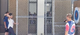
Today we did some last-minute grocery shopping and preparing for tomorrow’s departure toward Juneau. We enjoyed some of the local Independence Day festivities: these included things like the “Hatchet Throwing Contest” and “Survival Suit Race” – competitions unfamiliar to this Midwesterner. We stayed up late to enjoy the fireworks which began at about 11:20pm.

Hatchet_throw1.sized.jpg

Sunday, July 4, 2021
Petersburg to Thomas Bay

Distance today: 23
Distance total: 1043

Motor Hours today: 4.0
Motor hours total: 999.2

We dallied this morning in Petersburg and had breakfast in town before preparing to leave. With high tide shortly after 10:00 this morning and a relatively short distance planned for today, I figured we could afford to leave a little later. I also want to take advantage of the tide wherever possible between here and Juneau: it will be a longer run between fuel stops, and I have a couple side trips I’d like to make.

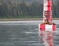
We backed away at 9:40 and followed Jeff and Susie in Idyll Time out of the fairway and into Wrangell Narrows. After passing the red buoy with the sea lions fighting for a spot, we pointed toward the left side of the Sukoi Islets on a northerly heading that would take us directly to the Thomas Bay entrance.

sea_lions_Petersburg.sized.jpg

Until we got to the Sukoi Islets, the water was fairly calm, with low swells from the north. Once we passed these islands, I think the wind against tide scenario resulted in the shorter, steep waves we experienced for the remainder of our trip across Frederick Sound. Neither winds nor tide were very strong, but we definitely experienced the high side of “Waves 2 feet or less” forecast for the sound today. The waves were more on the beam as we made the wide turn into Thomas Bay. They subsided once we were deeper into the bay, and we had flat water after turning south around Ruth Island. We’re anchored in 30 feet inside a small bay at the south end of Ruth Island.

While cleaning things up after arriving, I noted a boat on AIS entering Thomas Bay. I tracked him for a few minutes until realizing he was going toward the Baird Glacier and Scenery Cove at the north end of Thomas Bay (7 miles north of us). Shortly thereafter, he made a “Pan Pan” radio call on channel 16 stating that he was aground. Apparently, the aft part of his 57-foot boat was stuck at the foot of the Baird Glacier, and it was near low tide. The Baird Glacier is not a tidewater glacier, so there’s an exposed mud flat between the end of the glacier and the bay. Another cruiser had just entered Thomas Bay enroute to Scenery Cove, so was closer than we were. The responding cruiser did an excellent job of reminding him to put out an anchor to ensure that as the tide rose, he wouldn’t be pushed farther in.

It appeared there was no imminent danger, and the second cruiser confirmed that he looked OK and would just need to wait a couple hours for the incoming tide to lift him. During the entire process that included a couple other boats relaying info to the Coast Guard, the CG launched a helicopter from Sitka that overflew and talked to the captain, and the cutter Anacapa was in the Petersburg area and came up. Anacapa was anchored in the outer section of Thomas Bay as we left the next morning. The rising tide seemed to resolve the issue without apparent damage to their running gear, as this same boat motored in and spent that night in our anchorage south of Ruth Island.

Frederick Sound west of Petersburg
Frederick_Sound_enroute_to_Thomas_Bay.sized.jpg
 
Monday, July 5, 2021
Thomas Bay to Cannery Cove (Pybus Bay)

Miles today: 62
Total miles: 1105

Motor hours today: 7.9
Motor hours total: 1007.1

Departed the anchorage at 4:30 and made breakfast during the passage out of Thomas Bay. The gnats were atrocious when retrieving the anchor. After exiting the bay at low slack tide and turning up the center of Frederick Sound, we were met by short, steep waves. This didn’t bode well for today’s plan, and I turned back toward the north shore with plans to bail out at Farragut Bay if things didn’t improve. After several miles the waves subsided to a chop, so we continued toward Cape Fanshaw. We saw several whales along the north shore between Farragut Bay and Cape Fanshaw, including one that breached.

We passed Canoe Point, and the sea state didn’t appear worse that what we’d seen the last few miles. We were able to run most of the way across the open strait toward Pybus Bay at 16-17 mph, with the water surface alternating between a one-foot chop and light swells.

We dropped anchor in 35’ of water near the head of Cannery Cove shortly after noon. The high glacial cirque above the cove makes a most impressive backdrop.

Cannery_Cove.sized.jpg

You’re not alone here – there’s a busy fish camp (Pybus Point Lodge), and two other cruisers came in later to share the cove. On two separate occasions a small boat from the fishing lodge motored into the area where we were anchored and dropped crab pots for their clients, or at least I assume so since there were different “guests” each time but the same “guide”. In one instance they dropped a pot well within our anchor swing radius.

Cannery_Cove_Fish_Camp2.sized.jpg
 
Tuesday, July 6, 2021
Cannery Cove to Holkham Bay

Miles today: 47
Total miles: 1152

Motor hours today: 6.3
Motor hours total: 1013.4

We took our time this morning and had breakfast before leaving Cannery Cove. As it turns out, our anchor line wrapped around one of the crab pot floats as we swung at anchor overnight, so I had to untangle that before we pulled the anchor. Our plan was to just motor up to Snug Cove in Gambier Bay today, a total of only 24 miles. Once we go out into Stephens Passage, where the seas were very calm, I called an audible and headed toward Holkham Bay. Our plan after Gambier Bay today was Ford’s Terror tomorrow. Tomorrow would have required an early and longer day to arrive at Ford’s Terror for the early afternoon high slack. As calm as Stephens Passage was today, we decided to take advantage of it for the longer open crossing. With waves forecast to build to 3 feet later today in Stephens Passage, we ran on plane for the 15 or so miles from Gambier Island northeast to Lookout Point (5 miles south of Holkham Bay).

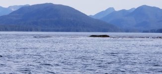
As we left Pybus Bay at near low tide, I noticed an exposed rock (see photo) that didn’t seem very close to or associated with one of the many islands near the opening. At anything but low tide it would not be visible, but would likely be close enough to the surface to ruin one’s day. It is marked correctly on the charts (and electronic charts) and highlights the need to review routes at higher resolutions for these types of obstacles. There was a C-Brats thread from a month or so ago about a large boat sunk on a rock in Prevost Harbor IIRC. This was a vivid reminder for me to check charts at various resolutions and heed the obstacles even though they’re not exposed above the surface.

Rock_Pybus_Bay.sized.jpg

Once inside Holkham Bay, the water was totally calm. It looked as if one other boat was already in the cove just inside Tracy Arm, and we aren’t going that direction tomorrow, so we anchored in a nook on the southeast side of the “Wood Spit” peninsula. It’s not a well-protected anchorage, but as calm as it is today, and with little change expected overnight, I think we’ll be fine. We dropped anchor in 40 feet at high tide and ensured that the lowest water in a swing radius was about 28 feet. The water is forecast to drop 12 feet overnight.

Holkham_Bay_Sum_Dum_Glacier.sized.jpg

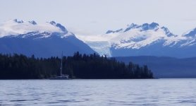
We’ve watched a parade of icebergs march down the Endicott Arm to Holkham Bay. Holkham Bay splits into two arms – the Tracy Arm goes north to the North and South Sawyer Glaciers, while the Endicott Arm angles south and east to the Dawes Glacier. Both calve enough ice that there are frequently icebergs that exit Holkham Bay into the Stephens Passage. We snagged a small bergie and hacked off a couple pieces to refill the cooler today. The vistas becoming bigger and more breathtaking. From our anchorage we’re looking directly across to the Sum Dum Glacier, which hangs in a valley above where the two arms separate. Looking up the Endicott Arm yields a staggering row of snow-filled mountains rising steeply from both sides of the fjord.

This is a very popular anchorage area. AIS shows no fewer than 10 boats anchored within 8 miles of me, though I can see none of them. At least two indicate on the other side of Wood Spit from me, and several are anchored in Tracy Arm Cove. I guess it makes sense given that we’re well within a single day’s travel of Juneau, and none of the three tidewater glaciers here have the restrictions of those in Glacier Bay. The chatter seems to be that the Sawyer Glaciers are more open than the Dawes, so hopefully most are going there tomorrow instead of up the Endicott Arm to Ford’s Terror.
 
Wednesday, July 7, 2021
Wood Spit to Ford’s Terror

Mileage today: 39
Total mileage: 1191

Motor hours today: 7.2
Motor hours total: 1020.6

Ever since reading of Jay and Jolee Byers’ earlier visits to Ford’s Terror, it’s been on my list of “must-see” locations if I had the opportunity to create my own Alaska itinerary. In many cases our expectations exceed the experience. Ford’s Terror didn’t disappoint.

Ford’s Terror was named by Lieutenant Commander H. B. Mansfield (USN), for H. L. Ford, a member of his 1889 surveying party. Apparently, Ford rowed a skiff passed the narrows during slack tide and then spent a harrowing 6 hours unable to leave the inlet due to the dangerous waves, currents, and blocking ice until the next slack allowed exit.

Since we didn’t have far to go today, and since high slack at Ford’s Terror was in the neighborhood of 1:40pm, we weren’t in a hurry to get up and move. When we got tired of waiting around, we left at 8:15, thinking we’d go up the Endicott Arm toward the Dawes Glacier before turning around to get to Ford’s Terror on time. We didn’t plan very well and didn’t leave ourselves quite enough time to get in view of the glacier. We had to slow to avoid the small clear bergies that sit low in the water and are difficult to spot, so we couldn’t just blast our way up there. We turned around 8 or 9 miles beyond the Ford’s Terror entrance. While we didn’t see the glacier itself, we saw seals hauled out on the ice and the magnificent canyon walls and waterfalls farther up the arm.

Based on AIS data and radio chatter, there would be at least 3 other boats bound for Ford’s Terror tonight. Another cruiser apparently bailed and returned from the Ford’s Terror entrance after arriving and seeing two other boats waiting south of the rapids. In the end, we and four boats waited for high slack to enter. I’ve heard or read of a couple estimates for calculating slack time at Ford’s Terror: 45 minutes after Juneau and 35 minutes after Wood Spit. These times end up being within about 10 minutes of each other and resulted in an estimate today for about 1:40pm. Based on radio chatter among those waiting when we arrived, nobody seemed certain of an estimate, though the loudest voice was using 1:05 (roughly slack at Wood Spit). They waited until the rapids seem to subside at about 1:00pm, then invited a smaller fishing boat with excess power to go first. After all three of the larger (43-, 57, and 64-foot boats) got through without carnage, we went through at about 1:10pm. We had plenty of power and directional control during this latter stage of the flood tide, but there was enough flow and churn that it didn’t quite feel like slack.

The favored anchoring spot in Ford’s Terror seems to be the western bank of western arm. All the other banks are extremely steep to, as the depth drops from 0 to over 100 feet in a very short distance. It’s all complicated by western bank having a mud flat that exposes as the tide drops and is difficult to discern – if you’re not careful you can ground on that flat as the tide goes out. The three large cruisers were concerned there wouldn’t be room for everyone, so had already made plans to raft together before arriving. Once they rafted together along the middle section of the western shore, there was plenty of room for the two smaller boats in the northwest and southwest corners. Our anchor landed in about 60 feet of water, and once we paid out 200 feet of rode and set the anchor, our back end was just short of where the depth near the mud flat goes from 30 feet to less than 10 feet at high tide (18 to less than zero during tonight’s -1 foot low tide).
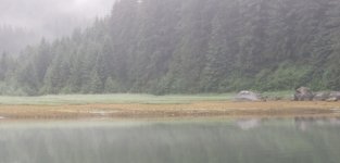
Fords_Terror_Low_Tide.sized.jpg


The most complete reference for Ford’s Terror navigation (IMO) is on the Slowboat.com blog (https://slowboat.com/2016/09/feature-ar ... ds-terror/), which also includes a link to the video from one of Jay and Jolee’s earlier adventures.
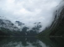
Fords_Terror_West_side.sized.jpg

Les and Kel Rohlf

More photos at https://www.facebook.com/kel.rohlf
Blog: https://souldare.com/intuition-diaries/
 
Thursday, July 8, 2021
Ford’s Terror to Taku Harbor

Mileage today: 53
Total mileage: 1244

Motor hours today: 7.3
Motor hours total: 1027.9

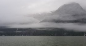
It was special to wake up in Ford’s Terror this morning on my 60th birthday. This is really an amazing place, with shear towers rising on all sides. It had an other-worldly feel this morning, with low clouds and mist obscuring the surrounding peaks.

Intuition_Fords_Terror_side_north.sized.jpg

We pulled down the dinghy and spent an hour exploring the anchorage areas of Ford’s Terror. We almost had our own misadventure after crossing into the east side (Evergreen Cove) midway through the flood tide. I noted a pretty fast current and some whirlpools as we transited the narrow channel, so we didn’t spend long there. Returning through the channel required full power to make 1 mph headway into the swirling current. Our Torqeedo electric motor will push our 10-foot dinghy at 5 mph at full power in flat water, so I didn’t leave myself much margin. Looking at the east channel at near low tide, I can understand why most don’t recommend anchoring there. The picture below was from near low tide – the entrance is awfully narrow, and rocks intrude into the passageway. You’d need to be confident of your line and transit only at high slack.

Looking into the east side (Evergreen Cove) at Ford's Terror
Fords_Terror_East_Entrance.sized.jpg


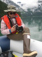
Looking toward the west anchorage area at Ford's Terror
Kel_Fords_Terror_Camera.sized.jpg

We pulled anchor and started out shortly before 1:00pm. High slack at the wood split was 1:45. The other four boats pulled out before us, so we followed. The outbound passage was complicated by bergs in the narrows and skiffs from the Wilderness Adventure cruise ship (anchored below the narrows) shuttling back and forth. We were the last of the 5 outbound boats to leave and went though the rapids at 1:54; and there were still significant standing waves and flooding current at the turn. Just after the rapids and before the final turn at the narrows, we were met by a large center console fishing boat in the middle of the channel, who had apparently not been listening to the four securite radio calls announcing the boats transiting from the north, and had not chosen to stay out of the path of the three larger boats that preceded us.

We met Akeeva (Sam Landsman) approaching from the south just as we finished our southbound passage. We continued back the Endicott Arm, exited Holkham Bay, and sloshed northbound to Taku Harbor for the night. The waves in Stephens Passage weren’t as bad as forecast (3 feet), but resulted in a busy ride. Things seemed calm when we anchored in Taku Harbor with about 6 other boats. An additional 8 were tied to the two floats in the harbor. Swells from the southeast wind must have made it into the harbor, as we experienced kind of a “rolly” night.

Les and Kel Rohlf

More photos at https://www.facebook.com/kel.rohlf
Blog: https://souldare.com/intuition-diaries/
 
Friday, July 9, 2021
Taku Harbor to Juneau

Mileage today: 24
Total mileage: 1268

Motor hours today: 3.6
Motor hours total: 1031.5

We departed Taku Harbor shortly after 6:00 am and headed toward Juneau. The following waves were mostly on the stern, so were not really uncomfortable. They settled as we moved further up the Gastineau Channel. We filled up with gas on the way into town and were assigned to the transient dock at Harris Harbor, the closest basin to downtown. I’ve arranged to have our motor oil changed at Auke Bay on Tuesday, so we’ll leave the harbor and run around Douglas Island to Auke Bay on Monday.

After doing some cleaning on the boat and laundry, we walked to the IGA for groceries and later to the Red Dog Saloon for dinner. The Red Dog Saloon seems geared toward tourists, though has a little different feel now without the cruise ship crowd.
 
Les, I for one, am really enjoying your write-ups. I had to be gone from I-net for a while, but back with you again and caught up. What a spectacular area. Thanks for adding the miles total. Kind of keeps it in perspective. Great photos.

You are probably too nice to do this, but I would have told that skipper dropping the crab trap that if it fouled on my anchor "I would sure enjoy the crabs for breakfast, and thanks for the trap. It's all good, for my troubles."

Harvey
SleepyC :moon

9_Sept_Seq_2019_Cal.thumb.jpg
 
Les, we too are very much enjoying your write ups, photos, & first time cruising SE Alaska perspective, especially now that you have been from Petersburg north. We are pretty familiar with all of SE Alaska, but much more so where you have been lately.

Pybus Bay is one of the most beautiful bays in SE Alaska, but your experience there well illustrates why we have avoided it pretty much since our first time there in 2004. Every return to Fords Terror, we find more & more cruisers have discovered it too. The first time we were there it was just us & that was when we made the mistake of exiting it during a fast moving ebb tide. We have been in & out of the East Arm many times in the C-Dory, Mokai & rubber inflatable & once at a very low slack tide in the CD22, where we had to work our way through the kelp & rocks very carefully. Great experience, but can’t say I would recommend it to others. We have never cared for Harris Harbor in Juneau & twice have taken the dry Mendenhall pass from there to Auke Bay at High Tide. Once with Brent & Dixie in the Discovery accompanied us & one time by ourselves & dark by the time Auke Bay was reached. Both times a kinda iffy trip but better then staying at Harris for us.

We will be staying tuned as your adventure continues & thanks for sharing it with all of us.

Jay
 
Les and Kel,

Thank you for your posts and photos. You guys are having a wonderful time! We are taking note of the details of your journey as we find they offer great information in travel through BC and into Alaska. We appreciate these details. Question, as you re-fueled along the way through BC, was water top-off for your boat always easily available to you at each Port at the gas docks or nearby? Thanks.

Gary.
 
We have been into Ford's Terror 3X with the Cal 46 and stayed 3 to 8 days each trip. Back in the 1990's it was rare to see one other vessel during our stays. Because of our draft of 6 feet, we always anchored in the East arm in 100' of water. (we carried 200 feet of chain, and 400 feet of nylon rode on the main anchor). We went in once with our C Dory 25, and another small boat was cruising with us--one other boat at that time. There are lots of good (some pretty steep) hikes.

We tried to get up the entrance inlet agains the flood time with our RIB--which would do slightly over 20 mph--we never had enough speed to breast the rapids.

We never saw a true slack water- if it was just starting to ebb at the outer part, it ws still flooding in the inner part of the past
 
Just checked back in and there was Alaska Desert on the table (C-Brats site). So cool. Really enjoying this. Great photos, and experiences.

Ahh yes, the infamous - and dreaded (and dangerous) are out there. I plan on them when on the motorcycle, and they are everywhere but . . .

". . . Just after the rapids and before the final turn at the narrows, we were met by a large center console fishing boat in the middle of the channel, who had apparently not been listening to the four securite radio calls announcing the boats transiting from the north, and had not chosen to stay out of the path of the three larger boats that preceded us."

There are those who think that; 1. They are above the curve and so don't really need to follow common sense or safety practices. or 2. Don't have or know how to use a VHF radio. Sorry, but I tend to put more fisher people into that category, but in actual practice, I have had 2 experiences with cruiser types, one each in Malibu Rapids with a 36 foot sailboat, and one at Dodd Narrows with a cabin cruiser type, about 45ft. Both had potential to go terribly sideways had it not been for some observant and swift thinking mariners.

And Yes, AIS was useful in both situations.

Glad to hear you were able to avoid sharing gel coat.

Harvey
SleepyC :moon

1_Jan_From_Inside_the_Electronics.thumb.jpg
 
Monday, July 12, 2021
Juneau to Auke Bay

Mileage today: 36
Total mileage: 1304

Motor hours today: 5.1
Motor hours total: 1036.6

It began raining steadily overnight and didn’t let up until this afternoon. We left Harris Harbor in Juneau about 8:30 am after checking out at the Harbor office. We needed to get to Auke Bay today, as we have an appointment for an oil change for our main motor on Tuesday. The forecast was for waves building to 3 feet in Stephens Passage, so I wasn’t enthusiastic about getting out. We had the ebb tide pushing us south out of Gastineau Channel and very little chop, followed by the flood tide pushing us north around Douglas Island with building waves. The worst waves may have approached three feet, but generally seemed less; we had a fairly comfortable transit at 8 mph up to Statter Harbor in Auke Bay.

Gloomy afternoon entering Auke Bay
George_Rock_Entering_Auke_Bay.sized.jpg

The harbormaster didn’t seem too confident about available moorage and gave us instruction to look around on the C and D floats. We were about ready to leave for lack of a space when we found a space almost big enough for us near the end of one of the fingers. It wasn’t close enough to a power pedestal with 30-amp outlets, but we shoe-horned ourselves in.

After the gloomy morning the rain stopped so that we could walk up to the Hot Bite for dinner. This little short-order establishment sits in the building that was originally the Pan Am ticketing office when Pan Am started Clipper service in 1940. Their Sikorsky S42 flying boats operated out of Auke Bay providing weekly service to and from Seattle. There are about 6 super-duper mega yachts parked on the break wall here, eclipsing the 2 or 3 we saw in Juneau.

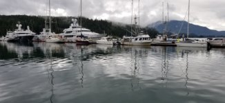
All Different Sizes at Auke Bay
Auke_Bay.sized.jpg
 
Tuesday, July 13, 2021
Auke Bay

Motor hours today: 0.4
Motor hours total: 1037.0

Lots more of that Southeast Alaska liquid sunshine today. Except for a few short interludes, a steady light rain fell all day. We untied and motored over to the ramp at 8:00 am to pull the boat for motor service. Conrad from Karl’s Auto and Marine Repair (the area Honda servicing dealer) met us with a big, 3-axle trailer onto which he loaded Intuition and towed it to their shop a few miles away. We’ve logged about 160 hours since the last oil change, so it was due.

For the three hours the boat was at the shop, we walked a few blocks to Starbucks for breakfast, browsed for a while at the Mendenhall Mall, and grabbed a load of groceries from Safeway. The boat work was done by noon, along with a power wash of the critters growing on the hull, as our boat does not have bottom paint. Given that we’ll probably add another 100 hours to the motor before we start our return trip south, I plan to swing through Auke Bay for another oil change near the end of our time here in the north part of the Inside Passage.

We were back in the water at Auke Bay looking for slip at 1:00pm. Thankfully, there was an open section of dock that was also near enough to access a 30-amp pedestal. Given this good spot, we’ll stay here through Wednesday and plan to start up the Lynn Canal on Thursday. We had date night at the laundromat this evening, so we now have clean and (mostly) dry clothes.

Headed to the laundromat
Auke_Bay_to_the_laundry.sized.jpg
 
Wednesday, July 14
Auke Bay

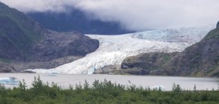
We caught the Juneau city bus that circles the Mendenhall Loop and got off at the spur road to Mendenhall Glacier. From there it’s 1.5 miles on a paved trail to the NFS visitors center. We toured the visitors center and walked the trail to Nugget Falls.

Mendenhall_Glacier.sized.jpg

Parking at Auke Bay seems a little like the wild, wild west. Rather than individual slips or long side-tie docks, they use sort of a combination for non-permanent slip-holders. Long finger docks jut out from the main floats to form a U-shape that can (usually) accommodate 3 shorter boats or 2 longer boats against the main float and each finger. In theory you can stay no more than 10 days without leaving, though some boats don’t appear to have moved much lately. The photo below is looking across to the opposite float and shows 4 fishing boats rafting together, with a long sailboat trying to exit from the spot it originally held in front of them. The good news is that people seem to work together to make a way for as many boats to fit as possible.

auke_bay_parking2.sized.jpg

The boat in the next picture also transited Canada from Washington. It’s powered by a Torqeedo electric motor, lithium batteries, and 1700 watts of solar panels. The owner said he can cruise at 5-6 knots and not deplete any battery power on sunny days. Cloudy days require use of batteries. Here’s a link to the builder’s info.
https://devlinboat.com/solar-sal-27-the-latest-launch-from-our-shop/

solar_boat.sized.jpg

Here’s the travelers’ blog – it took almost three weeks to make the transit to Ketchikan.
https://solarsaljourney.squarespace.com/blog
 
Thursday, July 15
Auke Bay to Haines

Miles today: 70
Total Miles: 1374

Motor hours today: 6.3
Motor hours total: 1043.3

We left at 5:45am in hopes of making as many miles toward Haines before forecast 3-foot waves rose in the northern Lynn Canal. The water was initially smooth and didn’t get higher than a light chop all the way to Haines. We ran at 14-15 mph for most of today’s run, except when we slowed for a couple whales and to make lunch. The Lynn Canal is impressive for the mountain ranges on each side – the western side guards the north and east sides of Glacier Bay, while the eastern peaks surround the icefields north of Juneau.

Lynn_Canal_northbound.sized.jpg

lynn_canal_east_side.sized.jpg

We received no answers from the Haines Harbor on either VHF or phone, so pulled into the harbor about noon and tied up to the transient dock. A couple helpful fishermen mending their gillnets pointed me to the dockmaster’s shack at the other end of the marina. It looks as if Haines has extended their breakwall and added a new ramp and dock at the south end of the harbor. The harbor is humming with activity from fishing boats steadily arriving and departing.

Haines has a little over 2,000 residents and sits on Portage Cove, an indentation on the Chilkat Peninsula. The whitewashed buildings of Fort Seward, an Army Post closed in 1947, now serve as homes for shops and businesses. We enjoyed wandering through Haines this afternoon. We checked out the very nice library and walked the mile to Raevyn’s Café, which serves Mexican and Cajun entrees. It’s a popular spot – all inside tables were taken, so we stepped outside and enjoyed our dinner in the drizzle. It’s located at the site of the Southeast Alaska State Fair, whose buildings were apparently built as part of the set for the Disney movie “White Fang”. We then headed (in the rain) across town toward the old Fort Seward where we checked out the tasting room at the Chilkoot Distillery.

Intuition_Haines_Harbor.sized.jpg
 
Back
Top