Intuition to Alaska - 2021

Yup, S P E C T A C U L A R and then some. Both the writings and the photos. Thank you so much. And Gary asked my question. BUGS, and how are you getting along with(out) them? Sounds like you hit the perfect timing at Glacier Bay Park. Have you had any issues with the otters climbing onto the boat? I know they will do that down here, but that is generally on the dock and if you have any food smells around.

Thanks again for your efforts in taking us along.

Harvey
SleepyC :moon

9_Sept_Seq_2019_Cal.thumb.jpg
 
Thanks for all your encouragement. This has truly been the trip of (at least my) lifetime. We're thankful circumstances allowed us to do the trip this year when we had several months available and less of a schedule. I really appreciate the perspectives from those of you who have explored this area previously.

In answer to a few questions:
Motor overheat warnings: the first one we experienced was in Queen Charlotte Sound and we could point to some debris covering the intakes and a long snaky piece of kelp wrapped around the prop. Nothing was apparent this last time en route to Glacier Bay, but I'm banking on Richard's explanation that something like a kelp leaf blocked the intake and fell off when we slowed down or raised the motor. I've run on plane several times since that incident without issue.

Bugs: the horse flies have been the biggest annoyance, though occasionally on still mornings the no-see-ums will attack when I go up front to uncleat the anchor rode. Perhaps the horse flies are God's retribution for my beer-drinking habits in college. The harbormaster at Hoonah half-apologized for them and thought they were worse this year than he remembered. They seem to like the warm, sunny days we've had recently. They limit the time we might otherwise spend on the cockpit while at anchor - fortunately it's comfortable in the cabin.

Otters: I've heard that otters will get onto boats, and saw one do so in Skagway. We talked with someone in Anacortes who had mothballs in plastic bottles hanging from several locations on his sailboat. This was apparently intended as a deterrent, since he had experienced this problem. After seeing all of them in Berg Bay I was a little apprehensive, but they moved to the other end of the bay when we anchored.

Anchoring depth: I have generally been able to find anchorages with 40- to 50- foot depths at which I drop the anchor. A number of the anchorages at the head of a bay will have an abrupt flat that is either too shallow or dries at low tide. If the water gets deep too quickly, it may be hard to anchor in 50 feet and still have enough scope without backing into those very shallow areas. In the couple cases where I've anchored in 60+ feet, I've put out a total of about 200' of rode, which includes 50' of chain. The weather has been very settled in those instances, so I was OK with a 3/1 scope. I'll start another thread related to anchoring - I've been using a technique for estimating and monitoring my swing radius and anchor placement that I'd like to vet with the braintrust here.

We arrived in Sitka today and are looking forward to a few days of walking, cleaning up, and exploring. We have good connectivity with both Verizon and AT&T, so will update the trip report and blog this week also.

Les
 
Thursday, July 29
Berg Bay to Hoonah

Miles today: 43
Total Miles: 1745

Left Berg Bay in time to hit high slack shortly after 6:00 am. As we were leaving the bay the Majestic Princess cruise ship was coming up Sitakaday Narrows from the south. With whale restrictions requiring both of us to stay 1 mile from shore south of Berg Bay, we opted to stand by and allow the cruise ship to pass, rather than force ourselves inside a mile of her.

Took our time heading south out of Glacier Bay to take advantage of the ebb tide. We transited the park boundary just after 8:00, which is when the National Park Service begins monitoring radio traffic for boats entering and departing Bartlett Cove and the park itself. It was a free-for-all for about 15 minutes while everyone reported their entry/exit/movement.

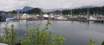
We had an uneventful run back to Hoonah, arriving to a traffic jam at the fuel dock. Rather than waiting for 3 much larger boats to fill up (seems there’s only room for one boat at a time here), we tied up to the public dock outside the marina. It’s close to the grocery store, so Kel made the grocery run while Les coordinated for a slip for the evening. The afternoon and evening consisted of stocking up, cleaning, and rearranging everything for the 3- to 4-day trip to Sitka. The evening was focused on finishing and posting to blogs. The cell connection in Hoonah is slow, so uploading large photos is a challenge.

Hoonah_harbor.sized.jpg

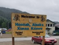
The Royal Caribbean Serenade of the Seas was docked at Icy Straits Point as we passed. They were there all day, so there was much more activity in Hoonah throughout the day.

Welcome_to_Hoonah.sized.jpg

_________________
Les and Kel Rohlf

More photos at https://www.facebook.com/kel.rohlf
Blog: https://souldare.com/intuition-diaries/
 
Friday, July 30, 2021
Hoonah to Tenakee Springs

Miles today: 51
Total Miles: 1796

We left Hoonah by 6:30 and worked to upload a few more photos as we exited the harbor and the cell signal faded. We made breakfast after turning east into Icy Straits and heading toward Chatham Strait. Winds weren’t strong, but coming out of the north created low waves on the beam. We fought the rising waves and ebb tide until turning south into Chatham Strait. There we got the benefit of the ebb tide southward in Chatham Strait. We accelerated to 15 mph in the relatively calm water. The further south we went, the more the waves built. While it wasn’t a terribly uncomfortable ride, the partly port-side following waves made for a busy driving experience.

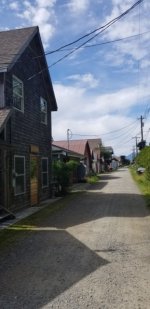
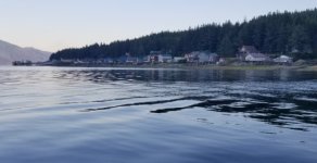
I was glad to make the turn into Tenakee Inlet, where everything calmed with protection from the northerly waves. We pulled into and docked at the Tenakee Harbor just before noon. Tenakee Springs is a cute town of houses built along each side of a single gravel road that parallels the water. The harbor sits about a half mile east of the central part of town. Guides indicated there was a general store and bakery/café in town, so we made that our first order of business. We grabbed a couple items from the small store (hours are 10-1); unfortunately, the Blue Moon Café and Bakery was not open due to pandemic concerns.

Tenakee Springs "Main Street"
Tenakee_Springs_Street_View.sized.jpg

The town pipes water from the hot springs into a bath house downtown. The bath house is open at separate times for men and women. We decided we didn’t want to make separate treks to the bathhouse, especially since it’s sunny and (dare I say) hot this afternoon. The horse flies apparently love this weather, as they were out in force.

Tenakee Springs from the water
Tenakee_Springs_Water_View.sized.jpg

_________________
Les and Kel Rohlf

More photos at https://www.facebook.com/kel.rohlf
Blog: https://souldare.com/intuition-diaries/
 
Les, did you guys check out the fuel dock in Tenakee? It's interesting to say the least. Just don't look up when they lower the hose down to you. lol. It is a cute town. They have a very small musuem, and the library is at the far end. Colby
 
Saturday, July 31, 2021
Tenakee Springs to Appleton Cove

Miles today: 53
Total Miles: 1849

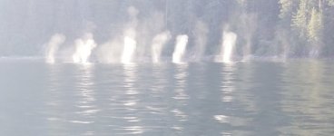
We cleared the breakwater at Tenakee Springs by 6:00 am, intent on completing our 20-mile run south on Chatham Strait as quickly as possible and before the seas rose to 3 feet as forecast. Our plan was slightly derailed by a group of whales. We could see their spouts backlit against the rising sun from at least 6 miles away as they loitered near the entrance to Tenakee Inlet. By the time we were near them, they were feeding along the south bank of Tenakee Inlet just off Chatham Strait.

Whale_spouts_Tenakee_Inlet.sized.jpg

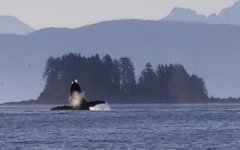
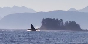
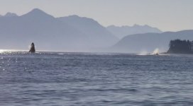
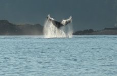
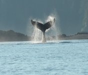
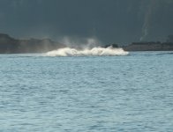
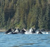
We stopped and watched them for nearly an hour – this was our first time seeing a group of whales this large (8-10 whales). At some point they became “exuberant”, with one whale continuously tail slapping, while two others breached repeatedly. After a couple minutes of this activity, they moved into the mouth of the inlet, at which point a second group of whales arrived. Both groups began bubble net feeding, each group exploding out of the water 2 or 3 times before they moved on. It was an amazing spectacle to witness this full range of activity.

Breaching (screen grabs from a phone camera video)
Whale_breach1a.sized.jpg

Whale_breach2a.sized.jpg

Whale_breach3a.sized.jpg

Tail Slapping
tail_slap_up_001.sized.jpg

tail_slap_up2.jpg

tail_slap_down.sized.jpg

Bubble-net Feeding
whales_bubble_feeding2.sized.jpg

Chatham Strait was fairly cooperative, with some sections of choppy beam waves. We slowed down upon making the turn into Peril Strait, where the water became calm. We’re anchored in 40 feet of water (low tide of 3 feet) in Appleton Cove. The entry includes a couple narrow turns and opens into a wide area with lots of room. I marvel at how easy it is to precisely navigate using today’s electronic charts and navigation tools. Staying in deep water through several turns (which aren’t obvious given the terrain) would be far more challenging otherwise.

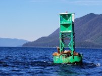
Green 35 at the Entrance to Peril Strait
Buoy_Green_35.sized.jpg

We’re sharing the anchorage with a bunch of Bonaparte’s Gulls (and plenty of horse flies). It’s entertaining to watch them dive into the water after small fish. They’re a smaller gull, and not nearly as vocal as the east-coast and gulf-coast gulls I’ve seen previously. Like yesterday, it’s clear with temperatures in the 70s.

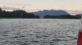
Sunset in Appleton Cove
Appleton_Cove_Sunset.sized.jpg
 
We liked the Tennekee town, but not the dungeon like hot springs there. You keep bringing back to us floods of memories. Our various trips there & down Chatham Strait, having to find safe harbors on the way, fueling & trying to fuel. Sorry you missed Dundas Bay, Elfin Cove, Pelican & the outside waters to Sitka, but still an amazing first cruise to these waters. As you write even without photos, I can picture your descriptions & know exactly what you are seeing & experiencing with it making me want to be there again & difficult the wait for next year.

Jay
 
Sunday, August 1
Appleton Cove to Sitka

Miles today: 58
Total Miles: 1907

The critical timing for today’s plan involved arriving at Sergius Narrows no later than the 12:06 pm slack. Since that was only 28 miles from us, we ate an unhurried breakfast before leaving Appleton Cove shortly after 7:00 am. We had a relaxed trip the remainder of the way up Peril Strait. A Nat Geo cruise ship passed us in the opposite direction while at anchor and another just after leaving Appleton Cove, so we wouldn’t have to contend with them at the narrows.

We arrived at Sergius Narrows about 45 minutes before slack. Looking into the narrows, the water appeared fairly flat, with little or no deflection of the three red buoys marking the channel, so we went ahead. There was still current in the narrows, but not swirling or turbulence. We had some rips as we made the turn south just after the narrows, but none were too threatening. I actually had more turbulence though a couple turns at the end of Peril Strait between Adams Channel and Arthur Point. The fact that this is a neap tide probably helps, since the max current was only 4 kts, versus almost 8 kts during the next spring tide.

Salisbury_Sound.sized.jpg

Shortly after passing through Sergius Narrows, the route opens into Salisbury Sound, which is open to the Pacific. The sea was benign through that section with only low swells. Two narrow channels of approximately 5 miles follow: Neva Strait and Olga Strait. Our challenge through those sections was navigating the wakes from numerous fishing boats who passed us on their way back to Sitka.

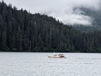
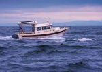
This photo of Intuition in Salisbury Sound was taken by the crew of Sudden Inspiration, onw of the two larger cruisers that checked in at Sydney immediately after us. We've met each other at various times throughout this summer's journey - they were headed out of Sitka as we were approaching.
Intuition_Salisbury_Sound.sized.jpg

Arriving in Sitka before 3:00 pm, we called the Sitka harbormaster to request a slip. He indicated he didn’t have any slips for a 25-foot boat and to look for a spot on either the north or south outer wall of Eliason/Thomsen Harbors. We saw what looked like an available spot on the south outer wall, so continued a little farther to Petro Marine to refuel before swinging back. The spot turned out to be right next to a 30-amp pedestal, so will work well for us. Being on the outer wall leaves us open to wakes from the constant parade of marine traffic, but most boats have been good about honoring the no wake zone.
 
Les and Kel, Really great writeups and pix. That early morning low light angle really helps spot the whale spouts against the dark (shadowed) backgrounds. Really nice pix you got there, and all along great photos. Enjoying your trip tremendously.

Harvey
SleepyC :moon

0_God_s_Pocket_Anchorage.thumb.jpg
 
Monday – Wednesday, August 2-4
Sitka

On Monday, we walked downtown to see what may be available for later days. There’s a small (700 pax) cruise ship in port today, so the downtown wasn’t too busy. There’s a larger ship scheduled for Wednesday, so that will be the day to avoid. We had a nice breakfast at the Mean Queen restaurant downtown.

On Tuesday, I got an appointment for a haircut with Malcolm at the Old Tyme Barber Shop to remove nearly 3 months of growth. We had a delicious lunch (Mac n Cheese with reindeer sausage) at BEAK, which is in the historic Cable House that now also includes KCAW, the local community radio station.

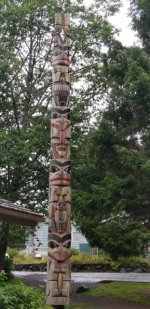
I hiked past Crescent Harbor marina and visited Sitka National Historic Park. The historic park had a very extensive collection of original and reproduction totems from southeast Alaska as well as a nice history of the local Tlingit clans and photo collections of E. W. Merrill. The fascinating photo collection from the late 19th and early 20th centuries is available to view on the park’s web site (https://www.nps.gov/sitk/learn/historyc ... ection.htm).

Totem_at_Sitka_Nat_Hist_Park.sized.jpg

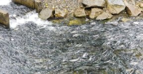
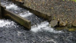
On the way back toward downtown, I stopped at the Sitka Sound Science Center and Sheldon Jackson Hatchery and took the hatchery tour, as the Pink Salmon were returning to spawn. This is the oldest operating salmon hatchery in southeast Alaska, raising and releasing Pink, Chum, and Coho salmon (https://sitkascience.org/hatchery/).

Salmon returning to Hatchery
Salmon_Sitka_Hatchery.sized.jpg

Salmon climbing the fish ladder
Salmon_climbing_ladder_Sitka_hatchery.sized.jpg

On Wednesday we prepared for the next phase of our trip to explore bays off Chatham Strait. I was hoping to get water in Angoon or (worst case) Kake during the next week, as that’s the commodity we’ll likely use most quickly. Unfortunately, nobody I called at either town seemed to know whether fresh water was available at their harbors, and the harbormaster didn’t answer their lines. I bought a collapsible 5-gallon water container and filled it in Sitka to carry as reserve.

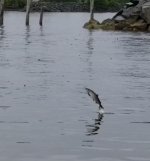
Salmon_jumping_Sitka_Sound.jpg
 
Thursday, August 5, 2021
Sitka to Baby Bear Bay

Miles today: 39
Total Miles: 1946

We took a last shower in Sitka and had a relaxed breakfast before departing. Slack at Sergius Narrows (30 miles from Sitka) was at 3:54 pm, so there wasn’t any reason to start early. We left shortly after 9:00 am and made a circuit south to Sitka Sound and then around Japonski Island to pick up the route north. Japonski Island includes the Sitka airport, hospital, and Coast Guard station. Its location creates a protected channel along which the Sitka Harbors are located. Along with numerous other smaller islands, it provides a protective barrier for Sitka from the Pacific Ocean. Today was the first clear and sunny day we’ve had in Sitka, allowing unobstructed views of Mount Edgecumbe.

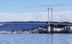
Looking North toward Sitka Harbors
Sitka_Harbors_from_south_of_bridge.sized.jpg

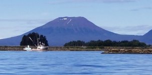
Mount Edgecumbe
Mount_Edgecumbe.sized.jpg

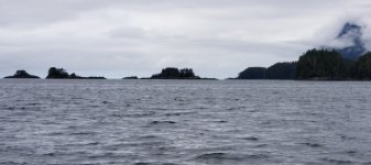
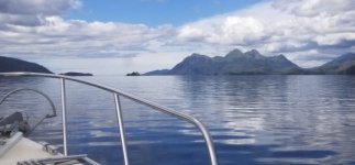
Exiting Neva Strait into Salisbury Sound
Looking_out_to_Salisbury_Sound.sized.jpg

The water was smooth all day, and we arrived at Sergius Narrows 90 minutes prior to low slack. The section immediately below the narrows where we’d seen some turbulence on Sunday was fairly calm, and I didn’t see any large waves or rapids when I looked into the narrows through the binoculars. I had just watched a larger cruiser motor up through the narrows, so I decided to go for it. Probably not the most prudent choice. I throttled up to max power, which normally gives me 18 mph with my fully loaded boat. I saw 14 mph speed over ground on the GPS as we entered, which didn’t surprise me as I expected up to a 4 kt current. The section of the narrows I couldn’t see from the lower end included a faster current that clearly deflected the buoys, along with a section of sizeable (2-foot) standing waves. Through this section I saw my speed on the GPS decrease to 10 mph. We had good directional control through the worst 200 yards or so of the narrows, but this would have been a very bad idea in a slower boat.

We continued just a few miles farther and entered Baby Bear Bay to anchor for the night. After slowly circling the bay to the end and allowing a group of kayakers from the parked small cruise ship to exit, we dropped the anchor near the head of the bay in about 40 feet. The end of the small bay is a 90-degree turn off the main bay and ends after another few hundred feet. Our anchor spot was conservative and would conceivably allow another boat to anchor between us and the end of the bay.

Just after I finished tying everything off and re-entering the cabin, a 60-foot Selene entered the bay. Without any attempt at communication, he passed within 50 feet of us and into the head of the bay. I initiated a radio call to him to let him know there was probably room, that he was over the top of my anchor at that moment, and that we were currently at the eastern-most end of our anchor swing. I didn’t mind that he wanted to anchor beyond us, but was slightly annoyed that he went closely around us to anchor without acknowledging. Perhaps he’s far more familiar with this bay than I am and was comfortable with the situation. In any case, it took a couple tries before he was able to place the anchor where he wanted it, given the limited space.

Neighbor in Baby Bear Bay
Baby_Bear_Cove_other_boat.sized.jpg

Sunset in Baby Bear Bay
Baby_bear_sunset.sized.jpg
_________________
Les and Kel Rohlf

More photos at https://www.facebook.com/kel.rohlf
Blog: https://souldare.com/intuition-diaries/
 
Friday, August 6, 2021
Baby Bear Bay to Hanus Bay (Portage Arm)

Miles today: 35
Total Miles: 1981

We left Baby Bear Bay at 8:00, shortly after low tide. We motored slowly through the couple miles of turns toward Peril Strait, getting a nice boost from the incoming tide. Once in the main east-west section of Peril Strait, the incoming tide switched, forcing us to work against it after that.

I wanted to arrive at today’s destination at high tide to verify sufficient depth, since we’ll be leaving at or near low tide tomorrow. The guide shows two entrances to Portage Arm of Hanus Bay: entering from the west forces you through shallow water; entering from the east requires you dodge submerged pilings. I chose the former. If there wasn’t going to be enough depth after the 13-foot drop during low tide, I’d try the east entry. On the line I selected, I saw at least 19 feet, so shouldn’t see less than 6 feet early tomorrow.

There was a large bear on the Catherine Island side of the portage when we arrived, but he didn’t stick around after I started to circle and survey the anchorage. The anchorage is described in one of the guides as “shallow”. From my perspective it was ideal, with about 25-foot depths at a 12-foot tide. This marked one of the few times I was able to anchor comfortably without having to put out nearly 200 feet (or more) of rode.

The weather forecast from this morning wasn’t quite as rosy as before we left Sitka, and it seems to be going in the wrong direction as of this evening. There are a couple different systems that could dump 3-7 inches of rain on the region through the end of next week. Of greater concern are the winds and resulting sea state, which may make it difficult to get back to Auke Bay late next week if we continue south in Chatham Strait. On Monday we confirmed with the shop in Auke Bay to service our motor one more time on August 17. We plan to leave Auke Bay after that to start our return trip south. We don’t want to risk missing that appointment, and getting 130 miles back to Auke Bay may be challenging if the weather stays as forecast through the end of next week. Tomorrow looks favorable for travel, but the conditions will deteriorate rapidly on Sunday.

It was cloudy and misty all day with some light rain in the evening and didn't take any pictures.
 
Saturday, August 7, 2021
Hanus Bay to Auke Bay

Miles today: 93
Total Miles: 2074

Motor hours today: 6.9
Motor hours total: 1137.8

The latest weather forecast as of early this morning confirmed our tentative plan from last night to at least start back north toward Juneau today. Today looked good for travel on Chatham Strait and Southern Lynn Canal, but the winds and waves are forecast to gust to 35 knots and 5 feet beginning Sunday.

At 6:30 am we carefully made our way through the shallow westerly exit from Portage Arm of Hanus Bay and turned toward Chatham Strait. One thing I noticed when running on plane this morning is that I’m only getting 4500 rpm at max throttle. Previous to this, I’ve been getting 4800 or slightly more. That’s still less than the 5000-5500 (IIRC) that I’m supposed to see from this (Honda) motor, but I’ve blamed it on the heavy cruising load and dinghy on top. Can anyone suggest reasons for this apparent reduction in top end?

We ran at 4200 rpm, which kept me at 14.5-16 mph all day long. It was a cloudy, sort of foggy day as we ran north up Chatham Strait. I crossed to the east side of the strait early on to the get some relief from the southeast waves on the beam. The shelter of Admiralty Island helped smooth the ride, which was fairly comfortable for the remainder of today’s trip. There were a large number of seining boats working the bays on the eastern shore.

Seiner_east_side_of_Chatham_Strait.sized.jpg

It was a nice Saturday, so there were lots of fishing boats to pick our way through after passing Funter Bay. We arrived at Auke Bay by 2:00pm and were fortunate to find a spot in the marina close to one of the electric distribution boxes on D-dock. It seemed less busy than our last time here in mid-July, though the marina did fill up by evening.

Rounding Point Retreat and turning south toward Auke Bay
Point_Retreat.sized.jpg

For now, our plan is to hang out here until the motor is serviced on 8/17. We stocked up in Sitka assuming we’d be out for a week, so there’s no hurry to get groceries. The forecast as of Sunday morning continues to look ugly all week, so thankful we made the decision to get here sooner than later.


_________________
Les and Kel Rohlf

More photos at https://www.facebook.com/kel.rohlf
Blog: https://souldare.com/intuition-diaries/
 
Hi Les and Kel,

Thanks for the updates and photos. We are enjoying the experience of your travel even if it is from the comfort of our couch. :)
Good call to make it to Auke Bay early to beat the weather and to make your scheduled oil change. You mention that you are only getting 4500 rpm at max throttle and that previous you were able to get 4800 rpm or slightly more and being stocked up in Sitka assuming you would be out for a week. The lower rpm could be from a change in how you have your boat loaded or trimmed. Does your Honda 150 have a carburetor?

I found a few possibilities for you or your Honda mechanic to consider.

Fuel condition. Type and Octane possibly old fuel
Propeller damaged blades
Restricted fuel pickup tube or anti siphon valve Fuel System Test
Crankcase oil volume, high oil level can cause aerated oil and lifter collapse
Marine growth on hull.
Restricted carburetor air intake (clogged flame arrestor)
Carburetor defective
Fuel pump pressure and vacuum
Boat overloaded, improperly loaded, or improperly trimmed.
Engine Overheating (You mention this before)
Engine timing and ignition system operation
Remote control cables and linkage for proper travel to open throttle plates fully.
Dirty or malfunctioning carburetor
Failing ignition system
Damaged propeller assembly

Let us know what you find out on the motor and thanks for sharing. Wish you both safe travel.

Gary and Colleen
 
Hi Les,
Regarding your WOT Rpm. I don't remember if you had bottom paint, but if you've noticed a drop in speed since you started out, it may be barnacles. When I was up there a few years ago with Midnight Flyer, and I ran mostly at hull speed, after a month the bottom of my hull was covered with hundreds of the little barnacles. I did powerwash them off at Hoonah on a tidal grid, and then again at Petersburg just before heading out. (We ran out of Prince Rupert.) The barnacles did affect my top end speed slightly the few times I did push it up. Colby
 
Thanks for the responses to my WOT RPM concerns.

Our Honda motor has fuel injection, so not concerns about the carbs. I thought about weight and distribution after I noticed the issue on Saturday. The only additional weight I could think of was the 5 gallons of extra water I was carrying; dumping that didn't seem to change the performance.

We had the bottom power washed as part of the motor maintenance last month. I know that can affect speed, but can it also impact the motor RPM at WOT? In any event, we'll get another power wash next week when the motor is serviced.
 
LesR":2fvskkqr said:
... I know that can affect speed, but can it also impact the motor RPM at WOT? ...

RPM is affected by speed (speed unloads the prop). If you are not getting your usual WOT speed, you also won't get your usual WOT RPM.

You can see this by starting from a stop. Place the throttle at some fixed position. As the boat speed increases, the rpm will also increase. Same thing happens when you hit a big wave. The boat suddenly slows down and the RPM will drop.
 
Here is a list of the equipment that either came with or that we’ve added to Intuition. Since I’ve referenced some of them other places, I decided to provide a listing here.

Power
Honda 150 outboard primary
Honda 9.9 outboard for emergency use

Ground Tackle
Primary anchor and rode: 22 lb Mantus M1, 50’ of ¼” chain, 300’ of ½” 3-strand line
Our experience with this anchor has been very positive. It “bites” quickly and we’ve not had any instances of dragging or issues with resetting. It has a long shank and point. I have a few dents in the stainless steel bow shield – it’s a tight fit on our bow roller.
Backup anchors: 25 lb Lewmar Delta, 16 lb Fortress
Backup rodes (2): 20’ chain and 200’ of ½” 3-strand and 8-plait line
Windlass: Lewmar V700 Pro-Fish (we do not use the Pro-Fish drop function) – new this year. After mangling the rode due to a kink in my old ½” 3-strand line, I replaced the rope portion in Wrangell and have had no issues since.

Plumbing
Airhead composting toilet added last year. With the scarcity of pump-out facilities in BC and SE Alaska, we needed a better option than the original marine toilet, as we could fill up the 9-gallon holding tank in less than a week. Our CD-25 was not originally equipped with a macerator pump.

Bosch point-of-use 2.5-gallon water heater. We removed the original 6-gallon water heater a few years ago. It had become unreliable, and I was not a fan of the long run of water from the heater on one side of the boat to the sink/shower on the other side. Removing the old water heater provided significant additional storage. The Bosch fits neatly under the galley cabinet, uses comparatively little space, and has a short run (< 2 ft) to either the shower or faucet. Using it requires shore power or running our Honda EU2000 generator.

Communication
2 fixed VHF radios, one with AIS receive functionality.
Handheld VHF radios in ditch bag.
Floating handheld with DHC in the bag we will carry on the dinghy.

Navigation
Lowrance HDS-8 Chartplotter with Insight maps.
Simrad GO-9 Chartplotter with Navionics and C-Maps charts.
Google Nexus 7 Tablet running Navionics app.
We installed the Lowrance when we bought the boat. Its Insight maps have been relatively useless for this trip. I use it primarily for the radar, big-picture overview, and sonar. I originally went with Lowrance, as that was the radar I planned to add. We added the Lowrance 3G radar a few years later. One of the reasons for going with Simrad for the new chartplotter is that it’s compatible with my radar. The Simrad chartplotter came with a TotalScan transducer, which provides a very clear view of the bottom. This has been helpful as we evaluate where to drop anchor within an anchorage.

Dinghy/Tender
Zodiac Wave 310 Aero with air floor (10’2”). This was a recent purchase after adhesive joints in our Alaska Series 270TDS tender began to break down after 10 years of storage in our (hot, humid) St. Louis garage. We’ve been happy with our limited use. I like that it has a drain for water that accumulates from rainfall.
Torqeedo 1103CL electric motor – limited use, but very pleased to date. This motor is supposedly equivalent to a 3hp motor and separates into components that weigh only 20 lbs. This makes it much easier and less stressful to mount it to the tender each time it’s used. At 25% power (225 watts), it pushes our tender at approximately 3.4 mph.

Heating/Cooking
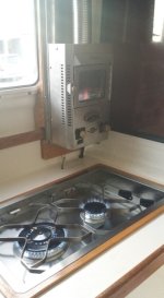
Dickinson 2-burner stove top
Dickinson Newport P9000 propane heater
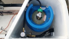
I constructed a dedicated propane locker in 2017 following (my understanding of) ABYC standards. The locker sits where a seat was located on the aft port side of the cockpit. Solenoid in the locker is controlled from a switch in the cabin. 4 sensors are located in the cabin, bilge through which hoses run, and the locker. We understand the concerns with propane. In our case it seems to provide the best compromise for the type of cooking we like to do, lack of odor, and single fuel for cooking and heating. Also, the Dickinson “fireplace” on the heater sure adds ambience.
We also have a small electric ceramic heater for use with shore power.
20171002_183225.sized.jpg

20171002_183635.sized.jpg

Refrigeration
Small Norcold refrigerator (original to boat)
35 quart Engel Deep Blue cooler in cockpit for drinks and other food items.

Electrical
Single AGM starter battery
Two 90AH Duracell AGM batteries (House)
1-2-Both battery switch
Battery monitor - Victron Smartshunt. I had problems previously with Victron monitors: not through any fault of the product, but my bilge doesn’t stay really dry and the contacts to the comm cable would corrode. I mounted the Smartshunt, which communicates via Bluetooth to my phone, in a small Pelican waterproof box, drilled holes in the box for wires to the battery, and sealed it with silicone. Thus far it’s working well.
I have a new Blue Sea ACR and compatible battery switch at home and had planned to install them prior to this trip. I ran out of time, so we stuck with the “1-2-Both” arrangement we’ve had and that has been reliable for us. I look forward to installing the new ACR and not having to worry about switching the battery switch regularly.

Solar Generator
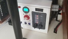
One of my projects earlier this year. I have a Goal Zero Yeti 400 that I have used for several years, along with 3 20-watt foldable solar panels. We use it primarily for running a CPAP and recharging electronic devices. I wanted something with more capacity, since I didn’t expect to be able to fully recharge the battery every day. I also wanted to keep two laptops charged. The new generator I constructed uses a 100AH Battle Born LiFePO4 battery. I included a 600 watt inverter and a Victron MPPT solar charger controller. I mounted a flexible 110 watt solar panel to the top of the bimini. The battery itself sits in the storage area below the dinette, and the input/output box sits along the wall below the dinette table. I connect the battery to the input/output box using Anderson PowerPole connectors. While our current need is on the boat, I built it so that it would be portable for use in other places. I don’t think I saved any money building this versus buying a comparable off-the-shelf unit, though I got the exact components I want and feel confident about replacing any components in the future.
Our experience with this has been extremely positive. The solar panel seems to fully recharge it on even cloudy and rainy days. Aside from nightly use of a CPAP, we use this to recharge two laptop PCs, 3 tablets, 3 cell phones, and a 12V box fan (didn’t think we’d have need for that). Having this extra power available allows us to worry less about the state of our house battery bank, which powers lights, refrigerator, and marine electronics.
Solar_Generator_Input_Outputs.sized.jpg

Other
Pool Mat on cabin and cockpit floors – softer and keeps feet dry when water inevitably ends up on the floor.

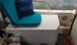
Storage Box in the cockpit.
I built this box specifically to store the generator, kicker/generator gas tanks, and grill. It also holds a few other miscellaneous items (extra line, water hoses). I sealed it all with expoy and made the cover using Shelter-Rite material. It doubles as a chaise lounge for Kel.
Cockpit_Storage_Box.sized.jpg

Insulated coating on walls to limit condensation. Several years ago, before a winter trip to Florida, we sprayed “Ceramic Insulation Coating” onto the interior walls, with extra layers on the walls of the berth area. While it doesn’t really insulate a great deal, it cuts down considerably on the condensation when it’s warm (and humid) inside the boat and cool outside.

Kitchen
A couple gadgets we bought before this trip and which have proven quite valuable. We learned about these during the Hontoon CBGT in March:

Sink cover
https://www.amazon.com/gp/product/B07F8 ... UTF8&psc=1
This covers the sink when not in use to allow additional counter space while still allowing limited use of the sink. My sink faucet occasionally drips, so this is a better solution than the cutting board I had originally built to fit over the sink.

Plastic bag holders https://www.amazon.com/gp/product/B07HJ ... UTF8&psc=1
Given that we use resealable plastic bags to store various food items and leftovers, these gizmos reliably hold the bag open to allow mess-free filling of the bag.
 
Working on my planning for the trip south. Since we didn't get to visit any of the Chatham Strait bays (Warm Springs, Red Bluff, Ell Cove), I'd like to go that direction on my way south, rather than Stephens Passage. The most direct route involves Rocky Pass, which sounds interesting and challenging. Anyone have recent experience with Rocky Pass or recommendations one way or another?

Les
 
Back
Top