iPhone Apps Useful for Boaters

El and Bill

New member
The discussion about iPhones and other devices has been great. Jim posted an excellent addition and referred to the importance of some of the applications for his medical practice.

Now, perhaps, it would be useful for those of us with devices to share the apps or sites that have been most useful for boaters. There are thousands of apps for iPhone, and most of us simply don't care to invest the time to search them, so perhaps sharing ideas on this forum would be useful.

I'll kick it off with:

1. Two Navionics Marine Charts (East Coast and West Coast) - low cost charts for both costs that link to GPS even when out of cellular range. Good for planning or backup navigation.

2. Active Captain - not an app, but a clickable add-on button. An excellent site for a cruising guidebook and for fine marine articles.
 
EquiQuery Windscale. I built this simple reference of the Beaufort wind scale. It's a simple thing. I want to build more apps, but have no time.
 
Another app that is fun when you are out on a trip is FriendMapper. This app lets friends track your location.

As for the coverage debate verizon v/s AT&T: Verizon does not cover our Olympia residence and offers spotty coverage in the waters of the south sound. At&T does much better down here. On the other hand, when we were in Desolation Sound and even with adding an international data plan, we got only limited coverage from A T&T and noted others including Canadians getting clear Verizon coverage while standing side by side.
In short, these two carriers are at war.
 
I have an iTouch and use
Boater's Pocket Reference
Navigation Rules
Pirate Insults (beats cussing)
Navionics Maps
Tide App
DayTides
Tides
 
Pat Anderson":2bmergw7 said:
That could be an app that looks like it was really doing something but just outputs "Bellingham Bay will be gnarly today"! Sorry, I couldn't help it! Once or twice on BB this year it was laying down flat, and we thought we had taken a wrong turn or something!

mshepherd":2bmergw7 said:
If you are from Bellingham area, I wrote this app that gives you live weather data on the bay.

http://itunes.apple.com/WebObjects/MZStore.woa/wa/viewSoftware?id=335343234&mt=8

Yeah, it is usually the worst water when we head out into the San Juans.
 
OK - first off, I bought the Navionics USA West. It is cool, works as advertised, and will be useful when I am not in the boat and do not have access to the Garmin units on board. I doubt that I will use it for navigating because I don't need it for that. The only problem is the damnable Warning splash screen that comes up when I load it. Any way known to man to get rid of that lovely feature? I already gave up on getting rid of it with the Garmins, so I thought I would try this one.

And, so it doesn't sound like all I do is whine, here are some cool free apps I use.

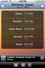
Sunrise Free is great for deciding when to start fishing legally. You set the preferred area once and get this screen when it loads. The arrows change the displayed date. The little ad at the bottom is the price for free.

IMG_0141_1.png


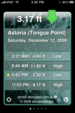
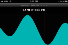
For tides, I really like Shralp Tide. Set the tide station, and it loads with the first screen. It has five pages for five days. Turn the iPhone sideways and you get the second screen. The best app for tides (opinion) I found, and it's free.

Picture_001.png


Picture_002.png


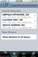
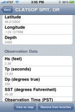
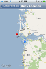
Another favorite for me is CDIP. Pick however many buoys you want from their list and you get the first screen at startup. The second screen is what you get when you select one of your stations (the screen grab was with it scrolled down some). The View on map feature takes you to Google Maps where you can zoom in and show your own GPS location for reference. Very handy for near shore conditions in real time. Also free.

IMG_0142_1.png


IMG_0143_1.png


IMG_0145_1.png
 
As some of you may already know, I 'm a techno-geek. On our trips down and up the California coast I downloaded and tried a lot of different websites and apps. Here is what I found to be most helpful on my iPhone:

http://www.wrh.noaa.gov/mtr/ - Mendocino County thru Monterey County
http://www.wrh.noaa.gov/lox/ - San Louis Obispo thru San Diego County

We also used the following apps extensively:
AyeTides (www.ayetides.com) - It is pricey ($9.99), but the tide/current database is built-in so it is not dependent on internet connectivity.
NOAA Buoy and Tide Data (previously called BuoyData) (www.veronasolutions.net) - An inexpensive ($1.99) NOAA Buoy Data Reader. Sure the data is free online, but this app makes it easy to find and use it.

Both apps are available through through Apple's App Store. It should be noted that as my father and I share an iTunes account, the software is on both our phones at no additional fee.

Yes I also had, the Navionics: US West app, the iNavX app, several good free tide apps, several buoy apps, including CDIP, several wind apps, etc., but these two apps proved to be the most reliable and/or the most used (the Navionics: US West app was carried as a backup only)

David
 
RadarNow - have it on the Droid and the Blonde's iPhone. Not "boat radar", but weather radar. I used it regularly on the cruise boat this summer, to avoid where the convective stuff was heading. Like others, Navionics and tide charts. While towing, I use GasBuddy to find the best price for fuel. And several different apps that help us find campgrounds; iNext to see what's coming up at Interstate exits.

Apps - not just for iPhones anymore. :wink: I have the Droid Bionic, she has an iPhone4... they both do all this stuff.
 
Back
Top