PNW 2022, Columbia River and San Juan Islands

I fueled at Fred's once and was a bit shocked by the price. I typically carry 2x5 gallon jugs every time I go boating. I fill them at a non-ethanol regular station for ~$2/gal less than the marinas. Hard to do when you're on the water, tho!

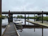
There is another fuel station on the Portland side of Tomahawk Island. Tomahawk Island is north of Portland - I-5 goes across the Island. The marina is upstream from the I-5 bridge over the slough between the island and the mainland. Lots of floating homes and boat slips in this slough.
 
I see the chart shows this island as both Hayden and Tomahawk. Perhaps they were 2 islands but at some point the gap was filled to provide vehicle access to Tomahawk. The marina w/ fuel access and most all the boat slips/marinas are on the upstream end.
 
Colby,
I live 20 min. from Scappoose /St. Helens launches and 25 min. from downtown Portland.
What has been posted has been my experience as well. I think your river trip plan is a good one.
 
Only a few more weeks before I head out for the PNW. If anyone is interested in joining me, here's your invitation. Not making this an official gathering, as I'm keeping the cruise on a flexible schedule. Plans are to launch in Warrenton (near Astoria) on June 3rd, and then cruise up to Portland via the Multnomah Channel. And hopefully if time allows, down to the Willamette Falls, and perhaps a bit farther beyond Portland to Beacon Rock. Then back down the main Columbia River channel to load out at Warrenton on June 13th. Plan to do all this at hull speeds (5-6 kts). At night I'll be anchoring out, staying on free docks, or marinas. Flexibility is key, as this is mostly a sightseeing cruise with no set itinerary other than the launch and load dates. (And even those are slightly flexible of +/- day depending upon my drive out, and timing to get to SEA to pick up my wife on the 14th.)

Then on June 17th launching at Cap Sante Marina in Anacortes to spend another week on the water cruising around the San Juans, to pull out on June 25th.

I will be running my AIS transmitter, and using the Nebo App.

Colby
 
Colby, Hope your travel trip goes well. There is a fair chance I will be able to meet up and cross wakes while you are on the water there. Probably in the Kalama or Cathlamet area.

Harvey
SleepyC :moon

JC_Lately_SleepyC_Flat_Blue_070.thumb.jpg
 
Sounds good Harvey. Just about have C-Traveler all provisioned and everything loaded. I plan to head out first thing Memorial Day morning. Just a bit over 2000 miles, and hope to launch by mid day on June 3rd. I topped the fuel tank off in Springfield Missouri a little over a week ago for $3.55 a gallon. Guess the next top off will be around $5/gal. :cry: For those wondering, I've found it doesn't matter rather I tow the boat with a full or empty fuel tank. I still get about 9.5mpg on average with the F150's 5.0L V8... Colby
 
Good photos Tyboo! Thanks. I'll see if I can upload a few later. Spent last night at marina in Cathlamet. (Not even going to try to spell it. lol) A bit choppy first part before the Astoria Bridge, and still some chop until I got abeam Altoona where the river narrows. I hear there are some free docks at Sand Island. Also about a nice museum at Kalama. Plan to check out the museum, then stop at Sand Island for the night... Did see some sun yesterday, but mostly clouds. Some rain. But that's in the forecast through the weekend. Love these enclosed cabins! Did have a little issue with my NMEA 2000 network earlier. I believe I have a lose connection somewhere. However, with a quick stop at a dock in Astoria, I disconnected and reconnected some of the cable, and that seemed to fix it, again, for now... I did take a pretty good wake from one of the Pilot boats before getting too far from Astoria. Think that was the hardest landing I've ever had, piloting either at American or in my boats! :shock: And I was only doing about 5mph. But two closely spaced wakes, and the second one pretty much launched me. I did take it straight on rather than at a 45 degree angle. Didn't expect it and especially the second one caught me off guard. (I was on autopilot, and had been fixing lunch at the table. Was back in the seat and after the first wake, jumped back to the table to grab stuff from falling, as the second wake hit. Boat slammed back down so hard it knocked me to the floor! Guess I need to paying closer attention to those guys!
 
If I'm reading it correctly, seems to show you doing 4-5 kph - any idea how fast the current is flowing?

-Joe
 
The current changes with the tides. The river flows backwards when the tide is coming in. I could be mistaken but I think the tide affects the river all the way to bonneville.

I see you are currently at Sand Island. We have stayed there many times with Hammerhead.

Have a fun trip, I would have liked to join you for part of it but haven't had any time for the boat lately... :(
 
Yep, at Sand Island. I'm estimating the current has been running at about 3mph. I'm not sure if the tidal fluctuation has much to do with it at this point. I know driving on the highway along the river between Pasco and Portland, it appeared to really be running, especially downstream of the dams. (Which makes sense, but then I guess I do remember it had a pretty good current when I cruised on it earlier with a group several years ago.) I think the tidal fluctuations has some affect on the current closer to Astoria, and I could notice a bit of difference in my speed below Cathlamet with the time of day relative to the tide/current charts. However, today it didn't seem to make any difference, and I notice there are no more current charts above one of the island near Cathlamet. Normally, in a calm, no wind or current situation, C-Traveler will get about 5mpg at 5-6 mph and 1600 Rpm. And around 1.9 mpg on plane while doing 16-22 mph or about 4400 rpm. Today at those rpms, I ended up at 3 mph or 17 mph, burning the same fuel flow of 1.7mpg. So much for thinking I'd save running slow! I ran on plane most of today. I hope to have this current when I go back, so can almost float back! :mrgreen:
I stopped at the Port of Kalama today to check out their little Interpretive Center. Some nice displays and information. This evening it looks like I'm the only one at Sand Island. There appears to be a sail boat, mostly covered in a tarp, and a pontoon boat. But I haven't seen anybody around. There was another pontoon boat and some folks that came over earlier, but they left. Pretty much an all day rain today, and stiff breeze out of the East. Colby
 
Finally, some more photos. Boaterhoming out.

001MitchellSDWalmart.jpg
Mitchell, SD. Walmart

002Badlands.jpg
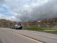
Badlands National Park

018RedShaleCampground.jpg
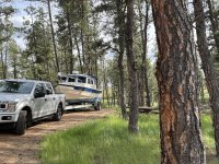
Red Shale Forest Campground near Ashland, MT

022_50000SilverDollarFreeRVPark.jpg
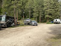
50000 Silver Dollar RV Park.


024TybooMikes.jpg
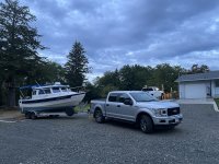
Camp Tyboo
 
025SkipanonRamp.jpg
Launched at the Skipanon River ramp

026SkipanonPumpOutDock.jpg
Heading out after dumping the porti potti at the dump station at the Skipanon Marina pump out dock

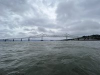
027AstoriaMegler_Bridge.jpg
Astoria Megler Bridge

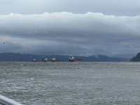
030AstoriaShipsAnchored.jpg
Ships anchored near Astoria

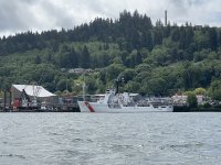
034AstoriaColumnUSCGCAlertWMEC_630.jpg
USCGC Alert with the Astoria Column in the background

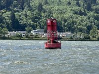
036SealOnBuoy.jpg
Seal relaxing on a navaid.

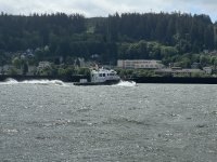
037AstoriaBarPilotBoat.jpg
One of the Columbia River Bar Pilot boats. This is the sucker that threw the large wake knocking me to the floor!
 
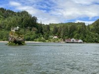
042PillarRock.jpg
Pillar Rock with the Pillar Rock Packing Co building in the background

053ElochomanSloughMarina.jpg
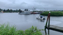
Elochoman Slough Marina

057CathlametJuliaButlerHansenBridge.jpg
The Julia Butler Hansen Bridge going into Cathlamet

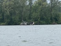
058CathlametChannelSunkBoat.jpg
This old sunken fishing boat off the Cathlamet Channel has been there a while.

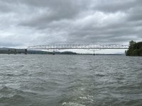
065LongviewLewisandClarkBridge.jpg
The Longview Lewis and Clark Bridge

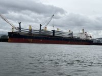
066ShipWindmillBlades.jpg
This ship especially caught my attention with the windmill blades.

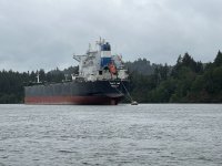
070TahitiOne.jpg
One of several ships anchored along the way between Cathlamet and Kalama.

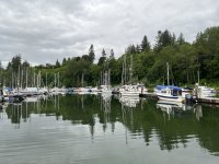
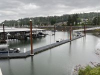
072PortofKalamaMarina.jpg
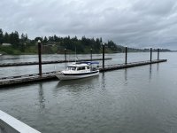
The Port of Kalama Marina Guest Dock.
 
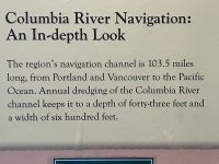
096PortofKalamaInterpretiveCenter.jpg
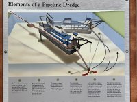
One of several displays in the Port of Kalama Interpretive Center

098PortofKalamaInterpretiveCenter.jpg
Another display

116RangeMarker.jpg
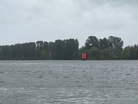
Range marker. For those not familiar, these are used to line up in the channel. I'm currently just left of the channel. If I were in the center, the line on the back board would be directly over and centered between the lines on the front marker.

120SandIslandSP.jpg
C-Traveler lonely on the Sand Island north docks.

124ShipnearSandIsland.jpg
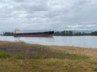
Ship coming by Sand Island.
 
Uh, I might have called him something else under my breath. lol. Load out on the 13th and head up to my brothers in Graham. Pick up the wife at SEA on the 14th, and then if the weather cooperates, we'll launch at Cap Sante on the 17th and spend a week cruising in the San Juans. Colby
 
Back
Top