bradley":2edi351j said:
Hello all-
We're thinking about a week in the San Juans this summer, launching from Port Townsend.
Just a couple quick questions as this would be a first for us.
Any idea how long this would take? And would you suggest following Widbey Island to Anacortes and then across, or head straight across to Friday harbor?
There's a lot of water between PT and SJ, should we be as nervious as we are?
thanks- brad
Much of what Tom said. From PT across to Friday Harbor on a good day is a dream trip. It can be flat as glass, see whales, dolphin and sea lions., or As mentioned, it can beat the snot out of you. IT IS weather dependant. From PT yo will also want the weather from Smith Island, as Heine Bank is a bit out of the way west, but still one of the closest reporting stations. The Tide rips, especially at Point Wilson, just around the corner north from PT are pretty famous. good to stay clear if you can see a wall of white.
If you have access to "Washburn's Tables" (West Marine has them) they are a good source for plotting current times ad strengths. Another source that I use frequently is "BIS Portal" (Boater's Information System) and here is a link to that. Easy free and reliable.
http://bis_portal.apl.washington.edu/bis_portal_app.php
Parking is good at PT, but more secure at John Wayne, Sequim, and the trip across the strait is closer from John Wayne. I would generally plan an early (daybreak minus 30) launch, getting me out of the bay and around the bend at sun up, Then at my 15 knots, it is about a 2 hour crossing, (again current dependant =- Check Washburn's for a current vector if it is running 2.5 plus), going straight north to Cattle Pass. the early hour is due to the generally least wind of the day, although that can be variable. (Check BIS for predicted winds in 3 hour increments through the day).
I have heard that if it is bumpy out, it might be better to run up alongside of Whidby. Have not tried that, but it came from a "Tow boat" captain. TIFWIIW. (Take it for what it is worth).
Winds and current opposition have been discussed. Worth paying very close attention to.
Of course it would be nice to have AIS, or at least a device with an ap for that. Generally the BIG ships are not an issue crossing. The Vessel Traffic Service can assist, and they are worth listening to, (VHF chan 5A or 14), for sure. If you have radar, it should always be on, and if it is foggy, it is your dearest friend. If not, you should not be out there if fog is in the weather report. A GPS only approach can kill you in the fog. The smaller, GO FAST types, including Victoria Clipper, can be a frightful surprise without the radar, even with they are not the biggest blip on the screen.
Depending on your plans, (where you are staying) a Washington State Parks Moorage pass might be a worthwhile investment. About $75 for a 22, and it pays for Moorage, float or dock and some very nice places.
Hope that is some help, and feel free to contact me (PM) is best if there is anything else I can help with.
Harvey
SleepyC :moon
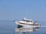
Not every day is like this, but when it is....................


