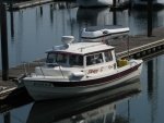
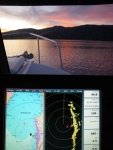
small radar

This has been a fun discussion. I agree with rogerbum wholeheartedly with the exception that when crossing the strait I generally run with the radar at 12 mile so it correlates with my AIS received targets. Once inside the islands, it comes down to 4-6 or less depending on the place.

One thing to remember is that IF you have radar, or any other navigational accessory (and I believe the USCG quantifies radar as a NavAid) it should be deployed at all times.

I have seen, birds (and clumps), kayaks, mooring floats, daymarks, docks, and a myriad of boats with mine, (7 year old Raymarine C120) and it has worked, always. For MARPA, the AIS is much faster, with more info. Both devices supplement the other, and I run them if the props are spinning.

Funny, driving last week in rather thick fog, I was wishing for radar in my car.

If you have it use it, If you don't, then be careful because either you shouldn't be in some places at some times, or you may get interested.

Harvey
SleepyC :moon
January_2010_344.thumb.jpg
 
Maybe it's just me, but when coming up to pass under lower smaller bridges on our radar they often show up as a blob. It's nice to have GPS at that time to see where you need to be headed if the channel shifts. I like bread crumb trails to get back and like most, I use radar to prevent being hit or doing the hitting. I'm ashamed I don't know how to use a sextant or anything about celestial navigation either. I use Coastal Explorer on a laptop with it's own GPS puck so it's a standalone to have as a backup for our Garmin 4208 for water depth, fuel monitoring, water temp and S.O.G. and radar overlay. I have friends who are loopers who have recently purchased AIS and they speak well of the addition, especially going down the Mississippi and other waterways with high speed ferries or lots of commercial traffic. I'll probably spring for a free standing AIS next with it's own screen. And get rid of an older Lowrance GPS multifunction unit that was just to have redundancy before we started using Coastal Explorer on a laptop. It's cool to have backup if anything craps out.
D.D.
 
Harvey, I was recently driving my car in thick fog and had the same thought - e.g. "I wonder if radar would be useful" or "I wonder if an FLIR camera would let me better anticipate the curves ahead". I have to admit that on that particular evening, not only did I drive fairly slowly, I glanced more frequently at the GPS to anticipate the coming curves. Worse yet, that evening while driving, one of my headlights burnt out. I was on the mountain loop highway around midnight so I had the choice of either pulling over and waiting until daylight at about 7AM the next day, or driving home on one headlamp. The latter was the better option at the time. But I sure would have appreciated some display that could see through the fog.
 
hardee":2ycqbnmz said:
One thing to remember is that IF you have radar, or any other navigational accessory (and I believe the USCG quantifies radar as a NavAid) it should be deployed at all times.

I respectfully disagree. In fact I usually disagree with absolute statements. I agree that radar can and should be used as a nav tool, and can be very useful even when visibility is not impaired by fog, precip, etc.

HOWEVER, there are certainly times when radar goes OFF. For one thing, radar should not be on when someone has their body in-line with the beam. Yes, newer radars have greatly reduced the harmful radiation, but this is something that both novice and experienced boaters do not seem to appreciate.

I know a guy who had radar mounted between his lower and flybridge helms (i.e. crotch level when on the flybridge) and regularly ran the radar while on the flybridge.

It's a powerful tool that can have some unintended consequences if not used properly and with adequate safety measures.

Another point made earlier that I would like to echo is that for little boats like ours, a RADAR REFLECTOR is an analog tool that can be as, if not more, effective in collision avoidance. All those big ships everyone wants to see and avoid using radar have very powerful radar themselves that often do not detect a little fiberglass boat unless there is a reflector on board. It's just as important that the ships can see you!
 
Kushtaka, I agree with the "absolute" statements. I am just going from memory from the COL-REGs book on the boat. Agree that you would not want to be frying anybody with your radar. On board, I don't believe that is an issue on the average 22 Cruiser, mine included. I have seen some mounted in some very disturbing places too, and I would not be there. Also agree on the usefulness of the radar reflector.

Roger, I have been there many times, checking the GPS -- with it dialed in to 1/4 mile or 1/2 mile to see those oncoming curves. And wished for radar on the car. Maybe some day. I have wondered about FLIR too, but not sure that it is very effective for just seeing roads. There may be others on here who have experience with the FLIR that have a better knowledge of that.

Will-C, The breadcrumb or GPS track is a very useful tool that I have been using for several years. It's nice when exploring, to find a quick way back to start. As to the stand alone AIS, I have been using the Watchmate Vision AIS and it is set up as a stand alone with it's own GPS and screen, My only real complaint is I am not so fond of the touch screen system. It is not as sensitive as I would like, for some functions. I do like the base map it uses, (coastal outline, they call it) which allows pretty easy position ID for where the other vessels are at currently.

I too, wish I new celestial navigation and sextant use, but really think the GPS with duplicate backup is adequate.

Harvey
SleepyC :moon

1_10_2012_from_Canon_961.thumb.jpg
 
hardee,

Don't wish for celestial navigation and using the sextant. Or you may have to use that method someday. I learned celestial navigation to prepare for the BIG TRIP. about 1990. At our last lesson, the instructor showed us a handheld GPS for $5000. In 6 months Magellan had them at ~$400. So much for celestial navigation.

The instructor called us in about 6 mos., saying he couldn't get another class together. I wished him well, and mentioned we now had a GPS and indeed were getting rid of the Loran. There's a reason GPS is used, It shows you really, really good lat, long. Not something within a couple of miles. Remember Amelia Earhart? With GPS she wouldn't of been lost.

So don't ask for something you really don't want.

Anybody want to discuss GPS reliability? That's a political discussion.

Boris
 
Boris is correct.

Today, celestial navigation is for romantics wishing they lived in the good old
days.

In the 90's I too took an on board celestial navigation course (aboard Ocean
Star - Bermuda to Norfolk). Besides learning some constellations I've long since
forgotten, the reference texts weight alone I'd much prefer now to have in extra
batteries for my GPS.

As far as accuracy, assuming it's not overcast when you wish to 'shoot', or you
don't have the shakes from that third cup of coffee, your time piece has to be
"right on" as well as your eye to catch the declination of a heavenly body within
an accuracy of a second or two to keep you within 10 - 100X the lat/long field
what now we get quick, easy and accurate with GPS.

Of course still today in the northern hemisphere, find Polaris (the North Star),
gauge it's angle off the horizon, and you have your approximate latitude.
But that won't get you into a dark harbor at night.

Heck, I'd opt to have my Loran C back before having to relearn celestial
navigation.

Aye.
 
Back
Top