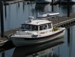
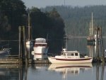
08/12 - 08/14 - Powell River BC, Canadian CBGT

bridma":8e42aovl said:
Hi Harvey,

We will be in the Gulf Islands on that Thursday. We'll talk again closer to the time. Do you receive these messages when you are out on the boat?

Martin.

Not much, I have a tablet to take with me this year but it has to have wifi from someplace. I still have a lot to learn along that line.

I have thought some about starting a VHF C-BRAT net like on the HAM side. I have been trying to remember the VHF channel I got in trouble for using in Canada that we use down here so much, maybe 68. I think it gets used for Vessel traffic or SAR service. If you know, I would be interested in knowing which one it is. It was not 16, 9, 71, 7, or 13. I thought the "net" would be good to be able to know what other C-Dorys are in your area.

Harvey
SleepyC:moon

1_10_2012_from_Canon_961.highlight.jpg
 
hardee":1c76fpwd said:
bridma":1c76fpwd said:
Hi Harvey,


Martin.

I have thought some about starting a VHF C-BRAT net like on the HAM side. I have been trying to remember the VHF channel I got in trouble for using in Canada that we use down here so much, maybe 68. I think it gets used for Vessel traffic or SAR service. If you know, I would be interested in knowing which one it is. It was not 16, 9, 71, 7, or 13. I thought the "net" would be good to be able to know what other C-Dorys are in your area.

Harvey
SleepyC:moon


Hi Harvey,
If you google vhf marine channels bc up will come the whole list of numbered channels and what their usage is for.

Sorry Ron if we have strayed off topic a bit, but for our American friends who are travelling north to the Powell River gathering, this info may help.

Martin.
 
Wow time flies! Too long ago I had said I'd suggest a few cruise routes to the PRCBGT well... here's the Strait Shots. I call them that because they are basically straight (as possible) up the Georgia & Malaspina Straits. Especially the East Side Strait Shot.
First a few disclaimers: I won't provide a lot of detail, that's up to you and your chart plotter. (or your paper chart and compass if you insist) These two routes are meant to be travelled in favourable weather only. ie under 10 knots of favourable wind. Check the marine forecast before you go. http://weather.gc.ca/marine/forecast_e.html?mapID=03&siteID=14301
If you are coming across the border don't forget to clear customs. Canadian C-Brats just shorten the distance you have to travel from your launch point

OK here we go.
STRAIT SHOT EAST- distance approx 105 N miles. I chose Bellingham as a launch point. Use that trusty chart plotter to find your way out of Bellingham bay, past Portage and Lummi islands. Keep as far to the east as your chart plotter will let you, as you are headed for Boundary Bay, just north of Blaine and the border.
Your first and the only stop is the White Rock BC government wharf where you will clear customs by Telephone. (unless of course you have Nexus) Wow, look at that. You already have got 25 NM behind you! Cool. And now you have cleared customs. No big deal EH?
What now? Well, check out that trusty chart plotter again and set a course to get out of the Bay and around Point Roberts USA. Yep, I've temporarily sent you back to the States. Actually you can't get out of Boundary Bay without going back in to US waters but thats OK as long as you don't stop at Point Roberts, rendezvous with any other boats, drop packages overboard or do any other foolish thing to attract the attention of the armed folks in those fast Ribs. One other note on Boundary Bay. Its shallow. Pay attention to the chart plotter and any navigation bouys.
OK so now we are around Point Roberts and the Strait Shot East really begins. Hey you already have 35 N miles done! This stretch is only about 50 N miles. Once again consult that chart plotter. Set yourself a way point up at the east or west side of Thormanby Is, at the start of Malaspina Strait. I usually choose the east side, cause the passage between Thormanby and Sechelt Peninusla is called Welcome Passage and thats a fun name. Plus the scenery is better.
Not much navigating to be done on this stretch. Just be aware of the huge shallows at the mouths of the South and North Arm of the Fraser River. They extend well out into the strait. There should be no problem if you are staying on the Strait Shot, but if you wander east...watch that depth sounder.
If you have one, let your auto pilot do the steering. All you will have to do then is, keep a sharp eye out for big floating steel things, called ships, tugs and ferries. You are paralleling and then crossing the shipping lanes into Vancouver. While you are paying attention to the big guys don't forget to look for other floating things, like logs, floatsam, jetsam, other C-Dory's and lesser boats. Avoid all these obstacles except for the C-Dory's, invite them to join you!

Well here you are in Welcome Passage. 85 N miles done and only about 30 to go. While you may be tempted to check out numerous interesting places near here, like Buccaneer Bay and Smuggler Cove marine parks. As well as Secret Cove and Pender Harbour, all well worth exploring, you are focused, and on a Strait Shot to the PRCBGT, so press on. Set a course for East Point about half the way up Texada Island. Thats that big 29 mile long island on your left. When you get to East Point just set a course for Grief Point. Hey. Grief Point. Its not as bad as it sounds. Can't be, we live just up the hill above the point and we'll wave as you go by. Actually, as you are only 3 N miles from the PRCBGT facilities in the South Harbour, we'll probably be down there to welcome you and help tie you up.

Well there you have it, The Strait Shot East. About 105 N miles, and, depending on your cruising speed (I'll use 18 knots) 6 hrs travel time. Not bad EH? Who said the PRCBGT was a long way away. Add in time clearing customs, a stop to stretch legs at Buccaneer Bay, and a 10% speed reduction and its still done in a <9hrs. From Bellingham! Cool.

Seriously though, as wonderful as it may be, I doubt anyone will choose to do Strait Shot just to come to the PRCBGT. You might choose however, to do a Strait Shot one way though, in order to have time to explore Desolation Sound, Princess Louisa Inlet or the Gulf Islands as well as the PRCBGT.

Anyone else that has done a previous strait shot, feel free to chime in with your thoughts and suggestions.

Well, I've been overly verbose with this so I'll leave the Strait Shot West (as well as a more leisurely itinerary) for another post.

Looking forward to seeing you at the PRCBGT.
Cheers
Ron
 
Nice write-up Ron!

So what gives fellow Brats? I see only 6 boats signed up for this gathering and only two from the states. What say you check your cruising calendars and add this event to your to do list? Powell River is so close to Princess Louisa and Desolation Sound. Sounds like a fun gathering and a great chance to cruise beautiful British Columbia!

Peter
C-Dancer
 
It takes me approx 7 hrs cruising time from Comox to Friday Harbor, and that is not going flat out. San Juans to Powell River is a similar distance.
So it really is a piece of cake for our southern neighbours, especially if you take a break with an over nighter in the northern Gulf Islands or the Sunshine Coast.
For those of you who have not been to PR before, you will really enjoy it. Great chandlery, pubs, cafe's, liquor store, all within a few minutes walk.
The marina showers are top notch, some of the best I have used.

As Ron and Peter say, lets get signed up.

Martin.
 
We would be signed up if we didn't already have a conflicting family trip and tickets purchased to fly to Virginia. We are just 3 of 17 people going so it is not really under our control.

Bummer..... so we will be looking for someone at FH to take the gathering supplies up north for this event.

Two medium size totes plus one smaller tote.

Greg
 
Peter, thanks for the reminder. I just checked, I wasn't there. No I am. Just like magic. Now, just making it happen, it's that "schedule on a boat thing" you know.

Harvey
SleepyC :moon

JC_Lately_SleepyC_Flat_Blue_070.thumb.jpg
 
We have been planning on this trip for some time, but did not get around to signing up. We are signed up now. We have a week before and a week after designated to the trip and plan to cruise from Sequim Bay to Powell River and surrounding attractions. We had tentatively planned to take a route through the Gulf islands and then cross the Strait of Georgia to Powell River. We would be interested in pros and cons of this route verses the east strait shot that Ron has described. We have never been in this area so any info we can get will be gold. Also we do fish and will be interested in any info we can get about that subject in the area of Powell River. Did I hear someone say something about a C-Brat Fishing Derby?
 
Hi Doug and Susan,

A big pro of coming up through the Gulf Islands is, wind protection, calmer waters, lots of places to see and stop over on the way. Do not worry about Dodd Narrows. The water in my bath tub goes down the plug hole quicker. Seriously, all restricted waters should be taken seriously. I do how ever transit Dodd Narrows 90 mins either side of slack. Never been a problem.
Once through you can either take a NE run to Powell River providing Whiskey Golf military training area is open (check Ch 16). Or skirt around it to the North and head for Malaspina Straight, south end of Texada Island. Or continue north up the Vancouver Island side, enter Baines Sound, and explore the delights of Comox. On the Friday morning you then cross the Georgia Straight with me. Approx 1hr 15mins.
I don't know much about fishing, but if you ask Harvey, he knows where the fish are, and his comes with chips :)

Martin.
 
I don't know from experience, but I have heard people say it can get rough between Texada Island and Powell River, so I would probably let the weather and tides help you decide on the route when the time is closer.

Having said that, I plan to go south between Texada and Powell River when I leave the CBGT.

But everything you do in a boat is influenced by weather.

I do agree that it might be easier and more protected to come up through the Gulf Islands and then decide whether to go on the east or west side of Texada Island once you get to Nanaimo.

I personally think going between Lasquiti and Texada is very nice, especially if you have enough time to stop and enjoy Jedidiah Island and surrounding area.

There are so many really nice places on the coast it is hard to recommend just one. You will have a nice trip no matter which route you choose.
 
Thanks for that post, Looks like a nice stop over, since I will be passing that on the way to PR. Surprised to see a restaurant on that small of an island.

Sandy beaches, sounds inviting.


Harvey
SleepyC :moon

0_CD_Cover_SlpyC_with_Classics_MBSP_2009_288.thumb.jpg
 
Harvey,
The restaurant on Savary Island is small and funky, good home made food though. Opening hours are a little hit & miss, no one keeps to schedule on these islands. Don't forget the pub on Hornby Island. The best fish & chips in the world (and I have eaten fish & chips all over the world!).
See you soon at FH.
Martin.
 
bridma":10977q9k said:
Harvey,
The restaurant on Savary Island is small and funky, good home made food though. Opening hours are a little hit & miss, no one keeps to schedule on these islands. Don't forget the pub on Hornby Island. The best fish & chips in the world (and I have eaten fish & chips all over the world!).
See you soon at FH.
Martin.

Thanks for the reminder Martin, I have it on my list ---> Thatch Pub, Right?

Harvey
SleepyC :moon

1_10_2012_from_Canon_961.highlight.jpg
 
That's correct Harvey. Thatch pub on Hornby Island. They have a nice dock right outside the pub where you can tie up for a few hours if you are going into the pub, no overnighters.
For overnight stays, go to the marina at Ford Cove. From there, it is a very nice 30 min walk along the trail to the pub. For anyone else stopping by as they head north to the Powell River gathering, Tribune Bay has the best sandy beach in the whole of the Gulf Islands, and for safe swimming, probably the best sandy beach in the whole of the PNW!

Martin.
 
Thanks Martin, I will have to work up a trip to that part of Vanc Is in the future as I am going to be trailering to Telegraph Cove for this time.

On your recommendation I will make it a destination.

Harvey
SleepyC :moon

1_10_2012_from_Canon_961.highlight.jpg
 
Tribune Bay has the best sandy beach in the whole of the Gulf Islands, and for safe swimming, probably the best sandy beach in the whole of the PNW

I really like Tribune Bay, it is one of my favorites as long as it's not a weekend in August when EVERYONE is there.

If I think the beach is too crowded, I often anchor a little to the west of the main bay in a place called Little Tribune. It is a local beach with less tourists and more relaxed rules so I can take my dog off the leash and let him play in the water.

A word of warning for those that care, but the local beach is clothing optional. I cover up from head to toe no matter where I am to avoid the sun, but many sun worshipers may enjoy the freedom.

Tribune Bay is a great anchorage except on a SE wind, then you should head to Ford's Cove or Deep Bay or anywhere else.

In fact, I may go this weekend for my maiden voyage of the year. It should be nice and quiet and totally wonderful.
 
We would be there in a heartbeat, we love Canadian gatherings! But this one is just too close to Bellingham for us, since we are hosting and have stuff to attend to! But all you cruisers, you can go right from Powell River to Bellingham!
 
Back
Top