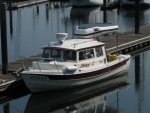
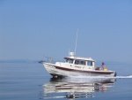
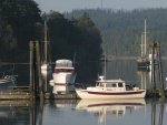
Wow time flies! Too long ago I had said I'd suggest a few cruise routes to the PRCBGT well... here's the Strait Shots. I call them that because they are basically straight (as possible) up the Georgia & Malaspina Straits. Especially the East Side Strait Shot.
First a few disclaimers: I won't provide a lot of detail, that's up to you and your chart plotter. (or your paper chart and compass if you insist) These two routes are meant to be travelled in favourable weather only. ie under 10 knots of favourable wind. Check the marine forecast before you go.
http://weather.gc.ca/marine/forecast_e.html?mapID=03&siteID=14301
If you are coming across the border don't forget to clear customs. Canadian C-Brats just shorten the distance you have to travel from your launch point
OK here we go.
STRAIT SHOT EAST- distance approx 105 N miles. I chose Bellingham as a launch point. Use that trusty chart plotter to find your way out of Bellingham bay, past Portage and Lummi islands. Keep as far to the east as your chart plotter will let you, as you are headed for Boundary Bay, just north of Blaine and the border.
Your first and the only stop is the White Rock BC government wharf where you will clear customs by Telephone. (unless of course you have Nexus) Wow, look at that. You already have got 25 NM behind you! Cool. And now you have cleared customs. No big deal EH?
What now? Well, check out that trusty chart plotter again and set a course to get out of the Bay and around Point Roberts USA. Yep, I've temporarily sent you back to the States. Actually you can't get out of Boundary Bay without going back in to US waters but thats OK as long as you don't stop at Point Roberts, rendezvous with any other boats, drop packages overboard or do any other foolish thing to attract the attention of the armed folks in those fast Ribs. One other note on Boundary Bay. Its shallow. Pay attention to the chart plotter and any navigation bouys.
OK so now we are around Point Roberts and the Strait Shot East really begins. Hey you already have 35 N miles done! This stretch is only about 50 N miles. Once again consult that chart plotter. Set yourself a way point up at the east or west side of Thormanby Is, at the start of Malaspina Strait. I usually choose the east side, cause the passage between Thormanby and Sechelt Peninusla is called Welcome Passage and thats a fun name. Plus the scenery is better.
Not much navigating to be done on this stretch. Just be aware of the huge shallows at the mouths of the South and North Arm of the Fraser River. They extend well out into the strait. There should be no problem if you are staying on the Strait Shot, but if you wander east...watch that depth sounder.
If you have one, let your auto pilot do the steering. All you will have to do then is, keep a sharp eye out for big floating steel things, called ships, tugs and ferries. You are paralleling and then crossing the shipping lanes into Vancouver. While you are paying attention to the big guys don't forget to look for other floating things, like logs, floatsam, jetsam, other C-Dory's and lesser boats. Avoid all these obstacles except for the C-Dory's, invite them to join you!
Well here you are in Welcome Passage. 85 N miles done and only about 30 to go. While you may be tempted to check out numerous interesting places near here, like Buccaneer Bay and Smuggler Cove marine parks. As well as Secret Cove and Pender Harbour, all well worth exploring, you are focused, and on a Strait Shot to the PRCBGT, so press on. Set a course for East Point about half the way up Texada Island. Thats that big 29 mile long island on your left. When you get to East Point just set a course for Grief Point. Hey. Grief Point. Its not as bad as it sounds. Can't be, we live just up the hill above the point and we'll wave as you go by. Actually, as you are only 3 N miles from the PRCBGT facilities in the South Harbour, we'll probably be down there to welcome you and help tie you up.
Well there you have it, The Strait Shot East. About 105 N miles, and, depending on your cruising speed (I'll use 18 knots) 6 hrs travel time. Not bad EH? Who said the PRCBGT was a long way away. Add in time clearing customs, a stop to stretch legs at Buccaneer Bay, and a 10% speed reduction and its still done in a <9hrs. From Bellingham! Cool.
Seriously though, as wonderful as it may be, I doubt anyone will choose to do Strait Shot just to come to the PRCBGT. You might choose however, to do a Strait Shot one way though, in order to have time to explore Desolation Sound, Princess Louisa Inlet or the Gulf Islands as well as the PRCBGT.
Anyone else that has done a previous strait shot, feel free to chime in with your thoughts and suggestions.
Well, I've been overly verbose with this so I'll leave the Strait Shot West (as well as a more leisurely itinerary) for another post.
Looking forward to seeing you at the PRCBGT.
Cheers
Ron
